As of 5 a.m. Wednesday, Beryl is holding onto category 4 hurricane strength with winds of 145mph.
Monday, Beryl became the first Category 5 storm in the Atlantic Basin in 2024, with winds of 160 mph. This is the earliest Cat. 5 on record in the Atlantic!
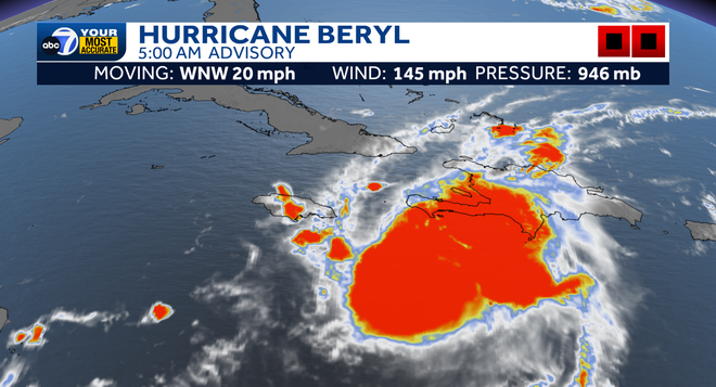
You'll notice that the eye isn't as visible this morning, as it has become cloud-filled encountering wind shear.
This shear will cause it to weaken over the next several days as it moves WNW through the Caribbean.
It is forecast to bring catastrophic storm surge and hurricane-force winds to Jamacia starting this afternoon.
From there, it is expected to gradually weaken more into a Cat. 2 as it tracks towards the Yucatan Peninsula of Mexico by the end of this week.
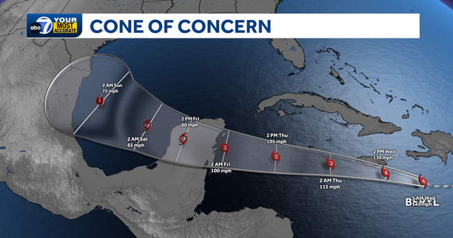
The important thing to remember here is that Beryl will stay FAR SOUTH of us here in Southwest Florida. Yes, this is a historic storm for sure. But it will not affect us in SWFL.
We will be monitoring Beryl over the next several days. Stay with ABC7 for the latest information.
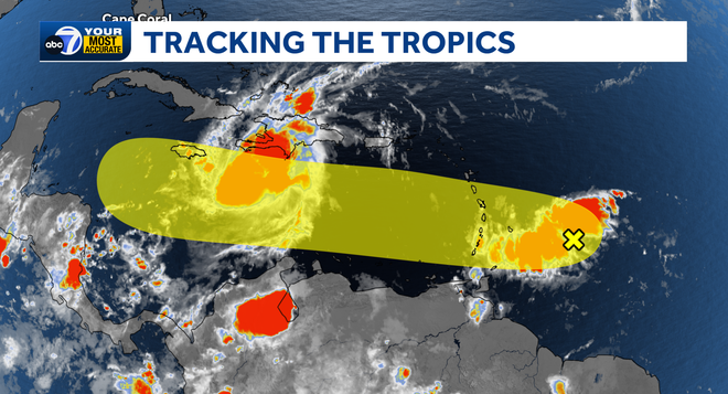
We also are tracking Invest 96 moving into the western Tropical Atlantic. This system is on track to move over the same regions that Beryl tracked through, likely not as strong of a storm since Beryl would have churned up some cooler water from below the surface of the Atlantic and will be running into dry, Saharan Dust. Invest 96 has a low chance of developing over the next seven days.
Follow the ABC7 weather team on social media
- Chief Meteorologist John Patrick on Facebook and X
- Meteorologist Jim Dickey on Facebook and X
- Meteorologist Jesslyn Ferentz on Facebook and X
- Meteorologist Sami Squires on Facebook and X
Watch our forecasts on TV or online
- Here's where to find our latest video forecast .
- You can also watch a livestream of our latest newscast here
Download our free ABC7 News app for the latest.