
Hurricane Beryl made landfall northeast of Tulum on the Yucatan Peninsula of Mexico early Friday morning.
The storm continues to weaken and is now a Category 1 hurricane with winds sustained at 85 mph. The forward speed is now toward the west-northwest at 16 mph.
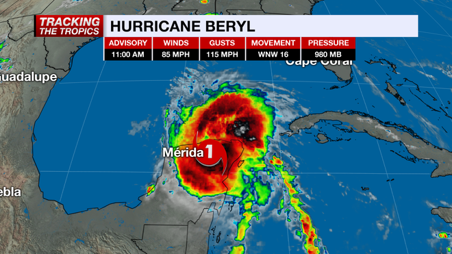
The storm is expected to bring 4-6' of storm surge, 4-6" of rain, and powerful hurricane-force winds to the Yucatan throughout the day. Land interaction will continue to cause Beryl to weaken briefly but heading into the weekend, Beryl will work into the Gulf of Mexico and gradually strengthen.
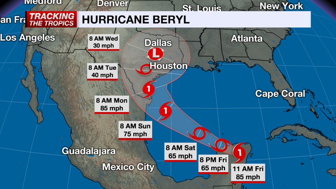
Forecast models aim to strengthen Beryl to a Category 1 hurricane before making landfall between Corpus Christi to Bay City, Texas by early Monday morning. Those along the coast of south Texas through Freeport need to monitor the track closely and make preparations for a potential landfall, storm surge, and excessive rainfall by the end of the upcoming weekend into early next week.
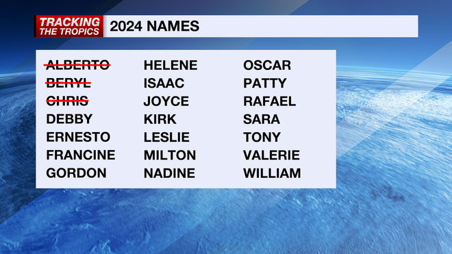
Beryl has been a remarkably strong and resilient hurricane for this time of the year. It set a series of records including being the earliest-forming Category 5 system in Atlantic Ocean basin recorded history. The statistical peak of hurricane season is September 10. There are no other areas of interest at this time. The next name on the Atlantic list is Debby.
Stay prepared throughout hurricane season by checking in on your hurricane plans and frequently checking the forecast. Count on the NBC 2 Hurricane Tracking Team to keep you informed.
Follow the NBC2 weather team on social media
- Chief Meteorologist Allyson Rae on Facebook and X
- Meteorologist Jason Dunning on Facebook and X
- Meteorologist Rob Duns on Facebook and X
- Meteorologist Justin Hobbs on Facebook and X
- Meteorologist Lauren Hope on Facebook and X
Watch our forecasts on TV or online
- Here's where to find our latest video forecast
- You can also watch a livestream of our latest newscast here
Download our free NBC2 News app for the latest.