
According to the National Hurricane Center, the storm struck near Matagorda, Texas around 4 a.m. local time as a Category 1 hurricane, with 80 mph sustained winds.
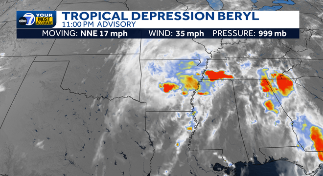
This is Beryl's third landfall. On July 1st, it made landfall as a Category 4 hurricane in Grenada in the Caribbean and then as a Category 3 hurricane on Mexico's Yucatan Peninsula on July 5.
Since it has pushed onshore, the land interaction has weakened Beryl significantly.
As of 11 p.m. Monday, winds have dropped to 35mph. However, significant impacts are still being experienced in eastern Texas, Louisiana and Arkansas such as heavy rain and tornadoes.
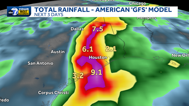
The storm will look to dump up to a foot of rain on parts of eastern Texas through tomorrow.
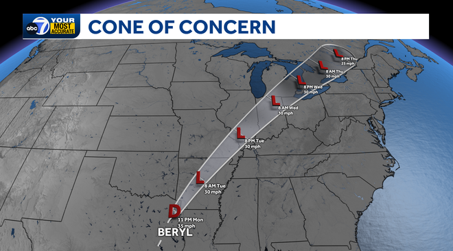
Beryl will break down as it tracks inland through the rest of the week, but remnant moisture and gusty winds will still work up through the Midwest through the work week.
No other areas are being tracked for development at this time, as the tropics will look to settle into a quieter pattern more typical of July for the next week or two. Stay with ABC7 for your Most Accurate Forecast this hurricane season.

Follow the ABC7 weather team on social media
- Chief Meteorologist John Patrick on Facebook and X
- Meteorologist Jim Dickey on Facebook and X
- Meteorologist Jesslyn Ferentz on Facebook and X
- Meteorologist Sami Squires on Facebook and X
Watch our forecasts on TV or online
- Here's where to find our latest video forecast .
- You can also watch a livestream of our latest newscast here
Download
our free
ABC7 News app
for the latest.