
Hurricane Beryl made landfall near Matagorda, Texas, as a Category 1 storm early Monday morning. The forward speed has slowed to 10 mph to the north-northwest.
As of 5 a.m. Monday, Beryl is producing maximum sustained winds of 80 mph with gusts as strong as 85 mph. The storm is producing dangerous storm surges and life-threatening flash flooding for Texas. According to the National Weather Service, Beryl is moving north at 12 miles per hour.
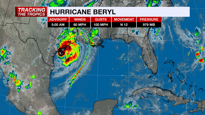
Beryl is expected to bring 5-7 feet of storm surge and hurricane-force winds. Because Beryl has slowed in forward speed, higher rainfall totals will be possible in Texas than what the storm produced throughout the Caribbean. Texas coastal regions are bracing for 5-10 inches of rain with isolated pockets of up to 15 inches.
LIVE RADAR | TRAFFIC CONDITIONS
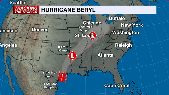
After landfall, Beryl will quickly weaken due to land interaction, but remnant moisture and gusty winds will still work up through the Midwest over the next few days.
Beryl has been a remarkably strong and resilient hurricane for this time of the year. Before entering the Gulf of Mexico, it set a series of records including being the earliest-forming Category 5 system in Atlantic Ocean basin recorded history.
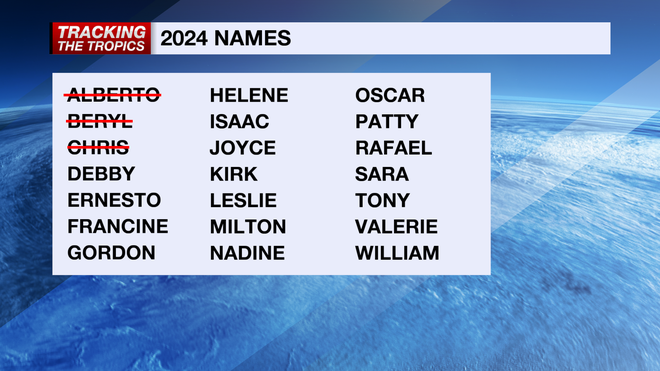
Other than Beryl, there are no other areas of interest at this time. The season, though, is just getting started, as the statistical peak of hurricane season is Sept. 10.
Stay prepared throughout hurricane season by checking in on your hurricane plans and frequently checking the forecast. Count on the NBC 2 Hurricane Tracking Team to keep you informed.
Follow the NBC2 weather team on social media
- Chief Meteorologist Allyson Rae on Facebook and X
- Meteorologist Jason Dunning on Facebook and X
- Meteorologist Rob Duns on Facebook and X
- Meteorologist Justin Hobbs on Facebook and X
- Meteorologist Lauren Hope on Facebook and X
Watch our forecasts on TV or online
- Here's where to find our latest video forecast
- You can also watch a livestream of our latest newscast here
Download our free NBC2 News app for the latest.