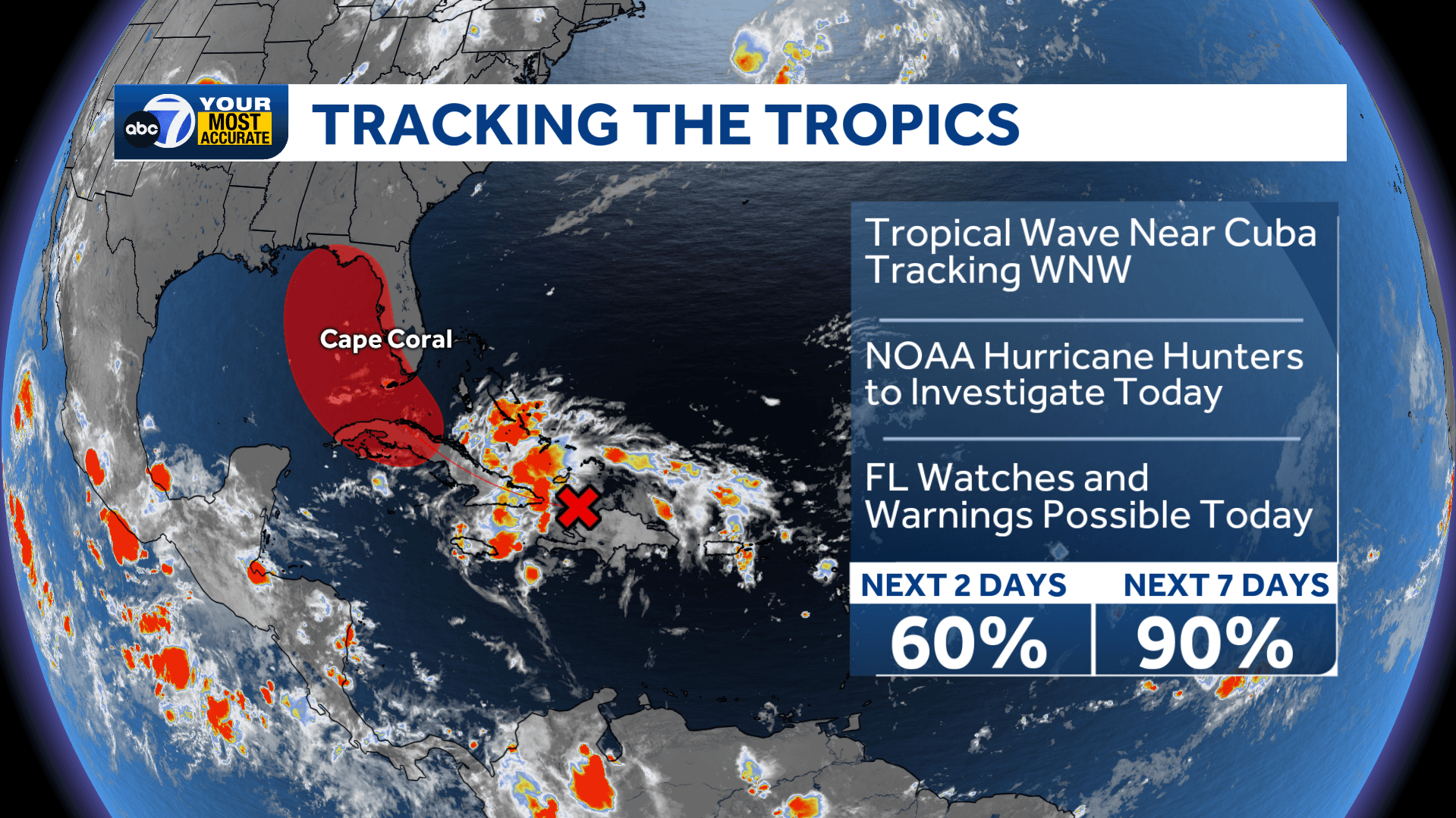
Chances for development have increased for a tropical wave bringing disorganized showers and thunderstorms to Cuba this morning. Odds are at 60 percent over the next two days and 90 percent over the next seven.
Any development is expected to be slow, but a tropical depression or storm may form on Saturday as the wave emerges over the open water of the eastern Gulf. If it reaches tropical storm strength, the next name on the list is Debby.
Model guidance does not project this to be a strong storm as it won't have much time over water. Regardless of development, the main impact in southwest Florida will be tropical downpours and a flooding concern.
Tropical storm watches and warnings may be issued for parts of Florida as early as Friday. NOAA Hurricane Hunters are scheduled to investigate this disturbance.
Starting Saturday afternoon, tropical feeder bands will work into our region. Many coastal areas will end up with 4-6' of rain with isolated pockets picking up 7-10". Inland areas will only accumulate a few inches of rain farther east from the system.
This does not appear to be a wind event with gusts only at 30 to 45 mph through the weekend. Have a way to receive weather alerts as isolated tornadoes and flash flooding will be possible by Sunday morning.
Keep in mind that we still have a long way until the statistical peak of hurricane season in mid-September. This is the only area of interest at the moment, but this season is projected to be far more active than normal.
Follow the ABC7 weather team on social media
- Chief Meteorologist John Patrick on Facebook and X
- Meteorologist Jim Dickey on Facebook and X
- Meteorologist Jesslyn Ferentz on Facebook and X
- Meteorologist Sami Squires on Facebook and X
Watch our forecasts on TV or online
- Here's where to find our latest video forecast .
- You can also watch a livestream of our latest newscast here
Download our free ABC7 News app for the latest.