A Tropical Storm Warning has been extended to include all of coastal Lee and Collier counties up to Englewood, which means tropical storm conditions are expected in this area within the next 36 hours.
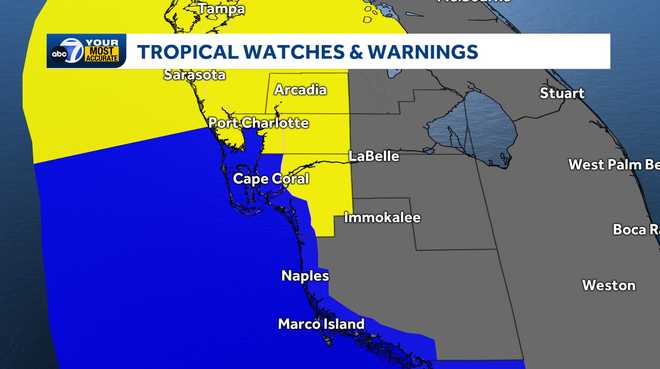
A Tropical Storm Watch is in effect for inland Lee, Charlotte and DeSoto counties, which means tropical storm conditions are possible within the next 48 hours.
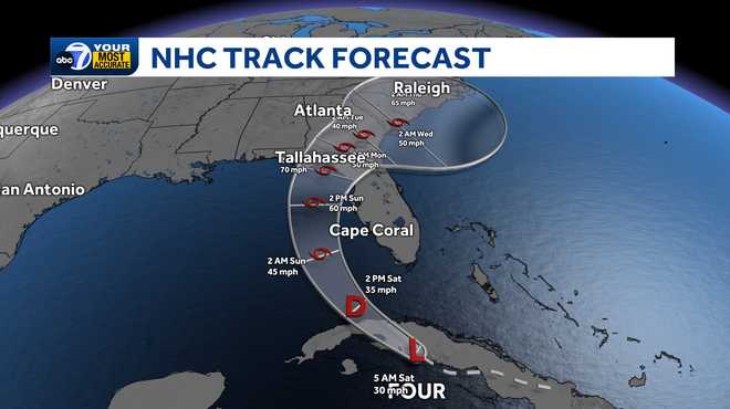
With wind speeds of 30 MPH, the depression now has a closed center of circulation but is not strong enough to be a tropical storm yet.
The depression is producing disorganized showers and storms over eastern Cuba.
Any development is expected to be slow, but a tropical storm is expected to form on Saturday as the tropical depression emerges over the open water of the eastern Gulf.
When it reaches tropical storm strength, it will take the name Debby.
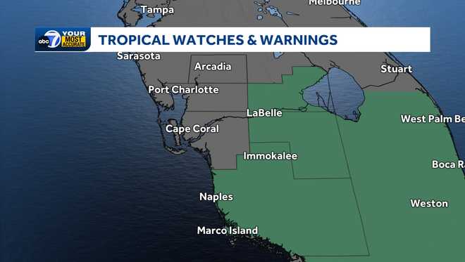
A Flood Watch is in effect for parts of Southwest Florida, including Collier, Glades and Hendry counties through Sunday night.
Excessive runoff may result in flooding of rivers, creeks, streams, and other low-lying and flood-prone locations. Flooding may occur in poor drainage and urban areas.
Model guidance does not project this to be a strong storm as it won't have much time over water. Regardless of development, the main impact in Southwest Florida will be heavy downpours and some areas of flooding.
Starting Saturday afternoon, tropical feeder bands will work into our region. Many coastal areas will end up with 4-6' of rain with isolated pockets picking up 7-10". Inland areas will only accumulate a few inches of rain being farther east from the system.
By Saturday night into Sunday morning, it will be a near washout for the region. If you don't have to be out on the roads, it is in your best interest to stay home as downpours will filter through the area.
This does not appear to be a wind event with gusts only at 30 to 45 mph through the weekend. Have a way to receive weather alerts as isolated tornadoes and flash flooding will be possible Sunday morning.
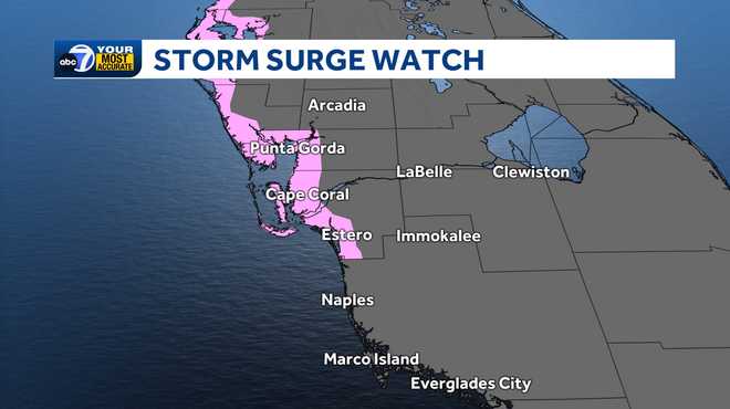
We will also be watching for storm surge between 1-4 feet.
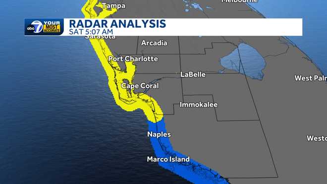
A storm surge watch has been issued for coastal Lee and coastal Charlotte Counties. Homes and businesses near the coast should especially watch for flooding during high tide Sunday morning.
Stay with ABC7 for the latest updates as additional watches and warnings are issued.
Follow the ABC7 weather team on social media
- Chief Meteorologist John Patrick on Facebook and X
- Meteorologist Jim Dickey on Facebook and X
- Meteorologist Jesslyn Ferentz on Facebook and X
- Meteorologist Sami Squires on Facebook and X
Watch our forecasts on TV or online
- Here's where to find our latest video forecast .
- You can also watch a livestream of our latest newscast here
Download our free ABC7 News app for the latest.