
ABC7 is closely monitoring Invest 98-L in the eastern Atlantic over the next week for development.
Chances for development are now up to 50 percent over the next two days but up to 90 percent over the next seven. The disturbance is currently in the central tropical Atlantic.
Showers and thunderstorms are becoming better organized, and a tropical depression may form in the next few days as the disturbance approaches the Lesser Antilles.
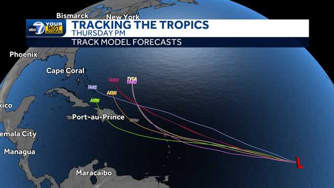
It is far too early to determine the long-range track or intensity, but it is not a threat to Southwest Florida at this time. Be sure to check back into the forecast for frequent updates next week.
This is the only area of interest at this time, but if it becomes the next tropical storm, it would take the name Ernesto. With nearly a month away from the statistical peak of hurricane season, the Atlantic Basin is likely to become more active.
Follow the ABC7 weather team on social media
- Chief Meteorologist John Patrick on Facebook and X
- Meteorologist Jim Dickey on Facebook and X
- Meteorologist Jesslyn Ferentz on Facebook and X
- Meteorologist Sami Squires on Facebook and X
Watch our forecasts on TV or online
- Here's where to find our latest video forecast .
- You can also watch a livestream of our latest newscast here
Download our free ABC7 News app for the latest.