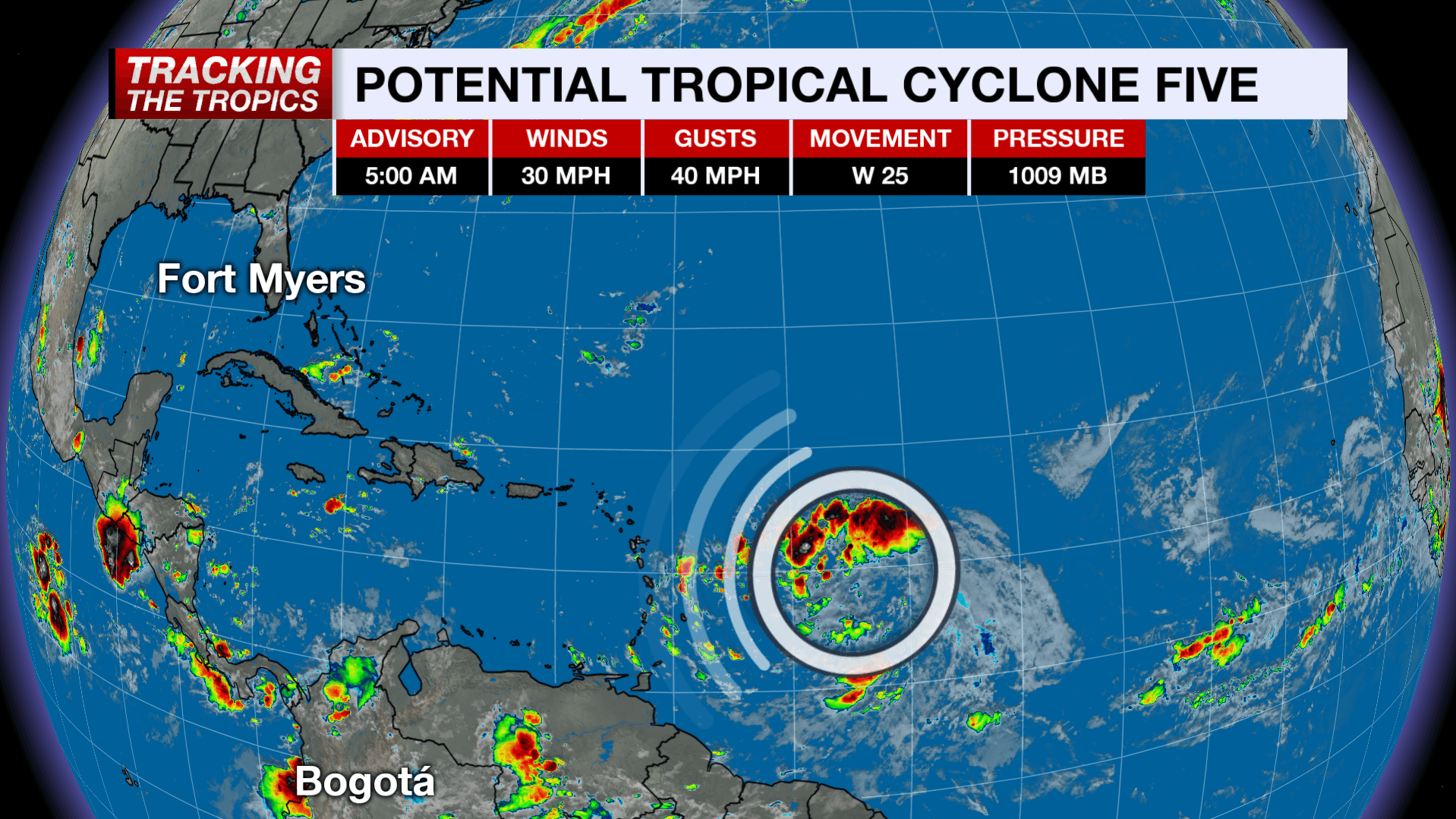
The NBC2 First Alert Hurricane Tracking Team is monitoring Potential Tropical Cyclone 5 (PTC 5) in the Central Tropical Atlantic, which could become Tropical Storm Ernesto as early as today.
As of 5 a.m. Monday, the National Hurricane Center started issuing advisories for PTC 5 which is currently over 600 miles from the Leeward Islands. The developing storm has sustained winds of 30 mph and is racing to the west at 25 mph.
The term "potential tropical cyclone" is a term used to describe a system that's not yet currently organized enough to be designated as a formal tropical system but is expected to organize into at least a tropical storm with impacts on land within the next 48 hours.
Using the term "potential tropical cyclone" allows the NHC to issue advisories for land areas that will be impacted by a system that's not yet put together enough to warrant a tropical depression number or tropical storm name.
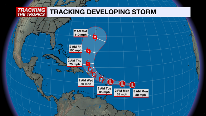
The developing tropical system is forecast to become Tropical Storm Ernesto by Monday evening and eventually Hurricane Ernesto as early as Wednesday. The current forecast has the hurricane intensifying into a category 2 hurricane during the second half of the week as it makes a sharp northward turn after reaching the Greater Antilles.
A front moving off the east coast of the U.S. will help deflect the storm away from the U.S. mainland, so the storm is not a threat to Florida.
The rest of the tropical Atlantic is quiet for now, but it's important to stay updated as we head into the peak of the hurricane season.
Follow the NBC2 weather team on social media
- Chief Meteorologist Allyson Rae on Facebook and X
- Meteorologist Jason Dunning on Facebook and X
- Meteorologist Rob Duns on Facebook and X
- Meteorologist Justin Hobbs on Facebook and X
- Meteorologist Lauren Hope on Facebook and X
Watch our forecasts on TV or online
- Here's where to find our latest video forecast
- You can also watch a livestream of our latest newscast here
DOWNLOAD the free NBC2 News app for your latest news and weather alerts.