
The NBC2 First Alert Hurricane Tracking Team is monitoring two areas of disturbed weather for potential tropical development over the next week.
Thankfully despite the number of areas being watched, none pose a direct threat to our local community for now.
To keep things clear, let's examine these areas and monitor them individually.
Area to monitor #1: The open Atlantic wave
The prime area for potential development to watch over the next week is over the Atlantic Ocean east of the Lesser Antilles.
For now, this tropical wave is producing little more than a disorganized cluster of showers and thunderstorms.
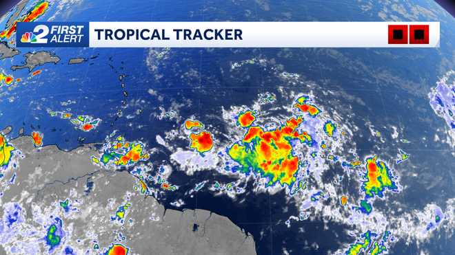
Through the upcoming weekend, this wave will keep moving toward the west. Though showers and thunderstorms are firing with it now, we are unlikely to see any major organization or development through Sunday.
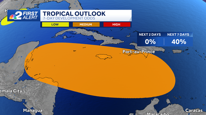
Because of this, the National Hurricane Center is keeping the odds of development at 0% over the next 48 hours.
However, forecast models have been aggressive at times with this wave as it moves toward the Caribbean Sea next week.
In the area highlighted in orange, the potential for development is considered to be at 40% over the next 7 days.
Though it's too early to determine if something will develop and where it will ultimately track, water temperatures in the Caribbean Sea are very warm.
The image below denotes where the highest ocean heat content is present in the Atlantic basin.
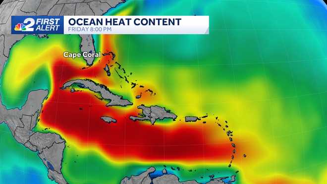
Ocean heat content refers to where the waters are warm, not just at the surface but through a profile of the upper levels of the ocean.
Should a tropical system move over this area, it would likely have abundant fuel for organization; one of many factors that influences how a tropical system may (or may not) develop.
We'll keep watching this wave as it moves west, but keep in mind for now that it's possible we may see more to come from this next week as it moves toward the Caribbean Sea.
Area to monitor #2: The western Gulf
For the last few days, numerous showers and thunderstorms have been firing across the western Gulf of Mexico with a disturbance off the coast of Texas.
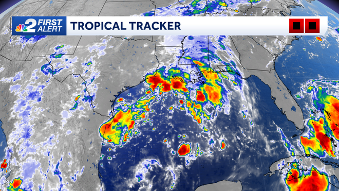
Given the time of year and the abundance of warm water in the Gulf of Mexico, features like this need to be monitored for tropical development.
Thankfully (at least for now) the forecast data isn't doing much in terms of the intensification of this disturbance and given its location in the western Gulf its influence on our local weather looks low.
We're just now approaching the peak point in the Atlantic hurricane season so be sure to stay plugged in with the latest forecast updates. We'll have the latest on NBC2 News.
Follow the NBC2 weather team on social media
- Chief Meteorologist Allyson Rae on Facebook and X
- Meteorologist Jason Dunning on Facebook and X
- Meteorologist Rob Duns on Facebook and X
- Meteorologist Justin Hobbs on Facebook and X
- Meteorologist Lauren Hope on Facebook and X
Watch our forecasts on TV or online
- Here's where to find our latest video forecast
- You can also watch a livestream of our latest newscast here
DOWNLOAD
the free
NBC2 News app
for your latest news and weather alerts.