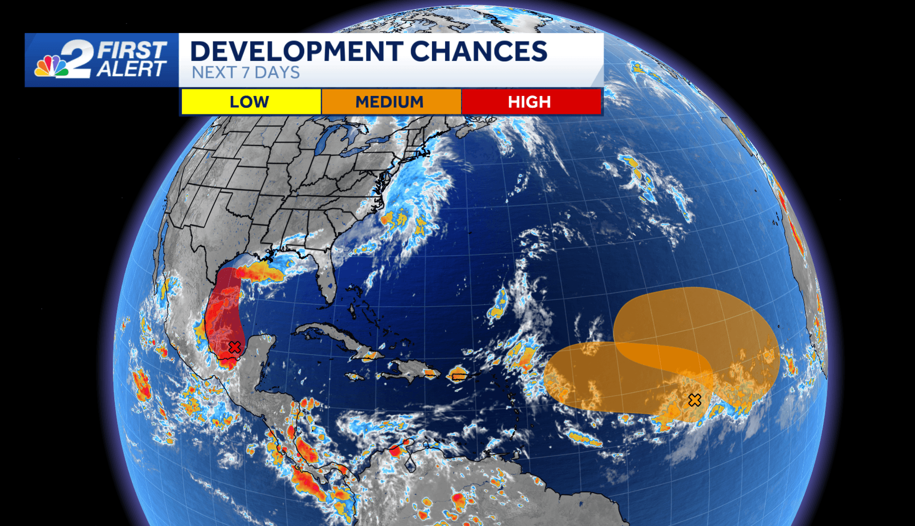
It's been over three weeks since we've had a named storm in the Atlantic, but this quiet stretch looks like it will come to an end in the coming days. There are three areas the National Hurricane Center is tracking for potential development, all with either a medium or high chance to develop into tropical depressions in the coming days.
The first is in the Southwestern Gulf of Mexico. An area of low pressure is producing disorganized showers and thunderstorms over Belize, Guatemala, and the Yucatan Peninsula of Mexico. The low is forecast to gradually lift northward over the next few days, and it is likely to develop into a tropical depression or tropical storm as it does, with an 80% development chance over the next 7 days.
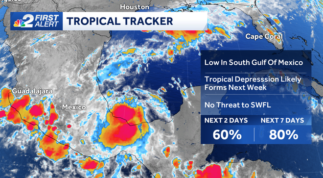
The next name on this year's name list would be Francine. Regardless of development, the storm will stay well to the west of southwest Florida. However, some models show the storm tracking toward, and potential making landfall along the northern Gulf Coast next week. If so, it would bring heavy rain, strong winds, and even the potential for storm surge flooding to coastal Texas and Louisiana.
The two other disturbances we're watching are in the eastern Atlantic. Both are moving slowly the west northwest, and both have a medium chance to develop next week.
Follow the NBC2 weather team on social media
- Chief Meteorologist Allyson Rae on Facebook and X
- Meteorologist Jason Dunning on Facebook and X
- Meteorologist Rob Duns on Facebook and X
- Meteorologist Lauren Hope on Facebook and X
Watch our forecasts on TV or online
- Here's where to find our latest video forecast
- You can also watch a livestream of our latest newscast here
DOWNLOAD
the free
NBC2 News app
for your latest news and weather alerts.