
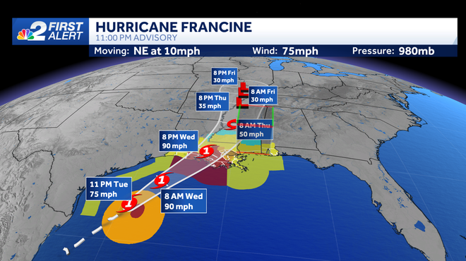
Francine is now a Category 1 Hurricane at 11 p.m. Tuesday and is expected to strengthen over the next 12 to 24 hours, before landfall in Louisiana sometime Wednesday afternoon. The window to strengthen is short before running into some wind shear before making landfall.
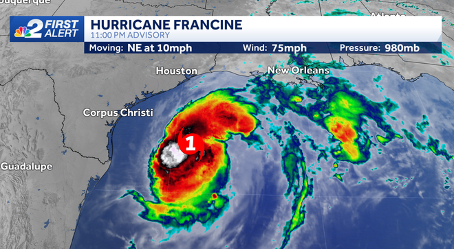
At 11 p.m. Tuesday, Francine has winds at 75 mph, with higher gusts. It's moving to the northeast at 10 mph, towards Louisiana. Sustained winds may be closer to 90 mph by landfall tomorrow.
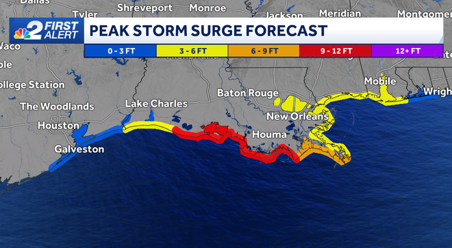
Storm surge and rainfall are the major concerns from Francine. The National Hurricane Center predicts between 9 and 12 feet of surge along much of the Louisiana coast. Even Pensacola, Florida could have up to 3 feet of surge from Francine.
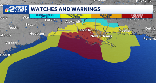
Storm Surge, Hurricane and Tropical Storm Warnings are in place across the northern Gulf. As far us SWFL, we will not be impacted by this storm other than a few extra clouds streaming across our sky as a stalled front drags them over from Francine.
Two other areas of interest are deeper in the Atlantic. The yellow area has been diminished to a low chance of development, so it's likely nothing will happen with this wave. The red one, however, has a high chance of developing over the next 7 days as it tracks to the west-northwest.
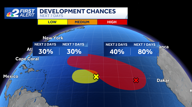
While none of these systems appear to pose a direct threat to us here in Southwest Florida, we'll be watching them for you closely.
Follow the NBC2 weather team on social media
- Chief Meteorologist Allyson Rae on Facebook and X
- Meteorologist Jason Dunning on Facebook and X
- Meteorologist Rob Duns on Facebook and X
- Meteorologist Lauren Hope on Facebook and X
Watch our forecasts on TV or online
- Here's where to find our latest video forecast
- You can also watch a livestream of our latest newscast here
DOWNLOAD
the free
NBC2 News app
for your latest news and weather alerts.