
The NBC2 First Alert Hurricane Tracking team is monitoring the movement of Francine as it moves farther inland over southeastern Louisiana. Francine has made landfall in southern Louisiana in the Parish of Terrebonne, about 30 miles south-southwest of Morgan City, as a Category 2 hurricane on Wednesday evening.
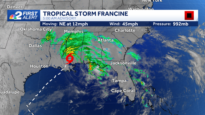
As of 5 a.m. EDT Thursday, Francine is a tropical storm again with sustained winds of 45 mph. The storm could transition to a post-tropical low sometime today.
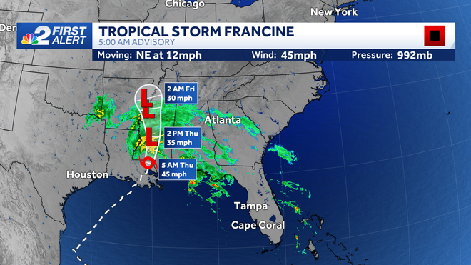
Its forward speed is being pegged at 12 mph as it moves toward the northeast.
Storm surge and flooding rains are the biggest concerns from Francine. Flooding rain is expected along the northern Gulf of Mexico coastline. Francine is bringing 4 to 8 inches of rain with isolated pockets receiving up to a foot by the end of Thursday.
Southwest Florida will not be impacted by this storm.
Follow the NBC2 weather team on social media
- Chief Meteorologist Allyson Rae on Facebook and X
- Meteorologist Jason Dunning on Facebook and X
- Meteorologist Rob Duns on Facebook and X
- Meteorologist Lauren Hope on Facebook and X
Watch our forecasts on TV or online
- Here's where to find our latest video forecast
- You can also watch a livestream of our latest newscast here
DOWNLOAD
the free
NBC2 News app
for your latest news and weather alerts.