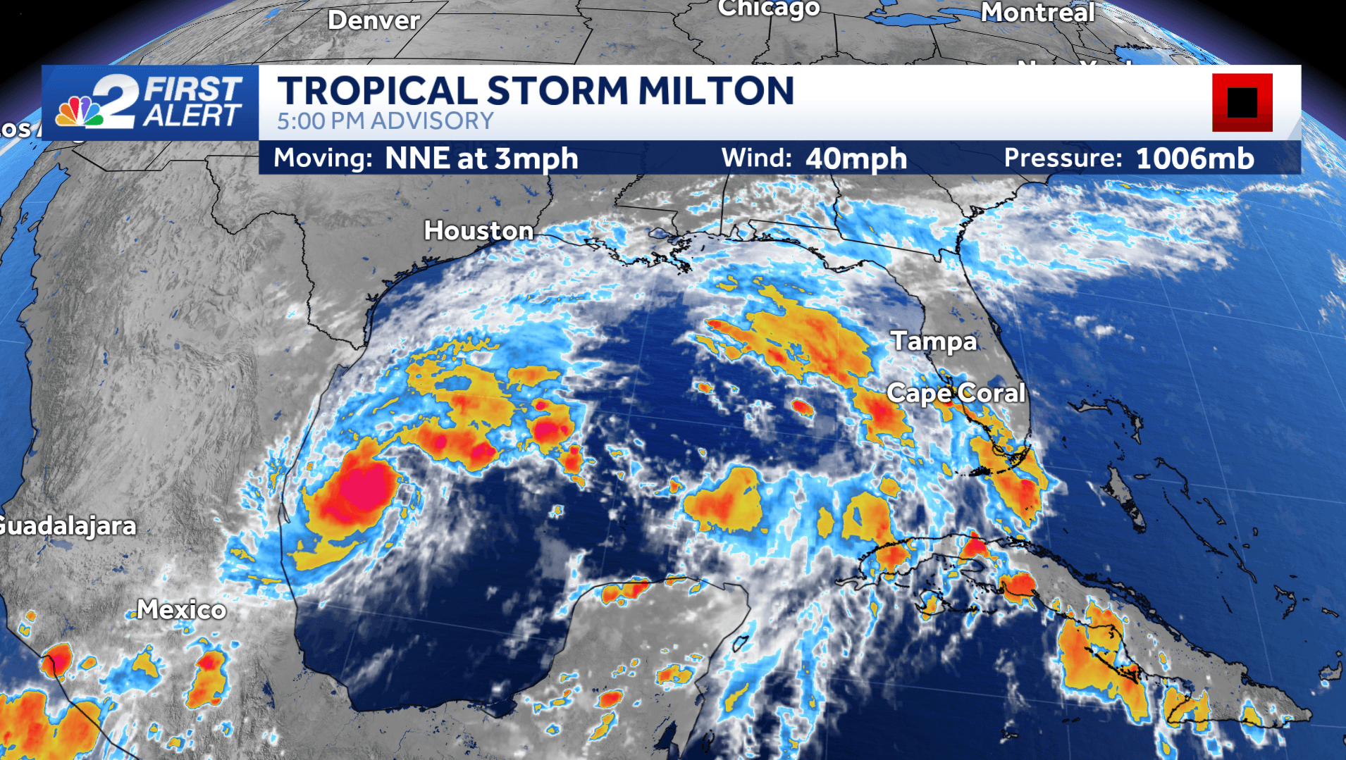
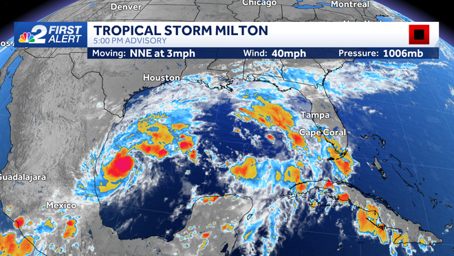
The NBC2 First Alert Hurricane Tracking team is tracking Tropical Storm Milton that formed in the SW Gulf of Mexico Saturday afternoon.
Maps, models and tracks
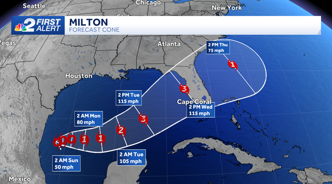
Tropical Storm Milton is expected to form into a hurricane before making landfall somewhere along the west coast of Florida by midweek.
Maximum sustained winds are estimated to be 40 mph, according to the National Hurricane Center.
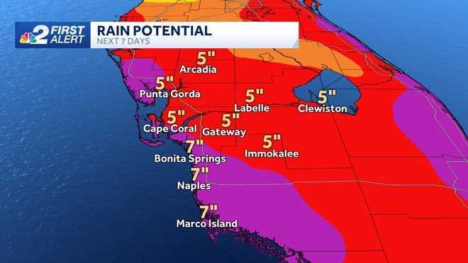
A Flood Watch has been issued for Charlotte, DeSoto and Lee counties from Sunday through Thursday morning.
Excessive runoff may result in flooding of rivers, creeks, streams, and other low-lying and flood-prone locations. Storm drains and ditches may become clogged with debris.
Heavy rainfall is forecast this week as deep moisture streams across the area. Then, as a tropical system approaches late Tuesday into Wednesday, the threat for heavy rainfall will increase even further. Rainfall totals of 4 to 8 inches, with isolated higher totals.
Given the latest trend in the forecast data, Southwest Florida is likely in store for what one could consider a one-two punch with the forecast.
The first punch is an increase in tropical moisture starting on Sunday that will remain in the area throughout the week. This will increase rain coverage in our community on Sunday, Monday and Tuesday and bring with it the chance of flooding.
With this in mind, members of our community should be preparing by doing what they can to mitigate the flood risk for the first part of next week as we look for clarity on how much of a wind or surge threat we may face later in the week.
Since Saturday's forecast is expected to be fairly quiet, use the day to clear drains on your property, clear debris from your gutters and fill sandbags if that's something necessary for where you live and your home's risk level.
Count on the NBC2 First Alert Hurricane Team to keep you updated throughout the weekend as we closely watch the Gulf of Mexico.
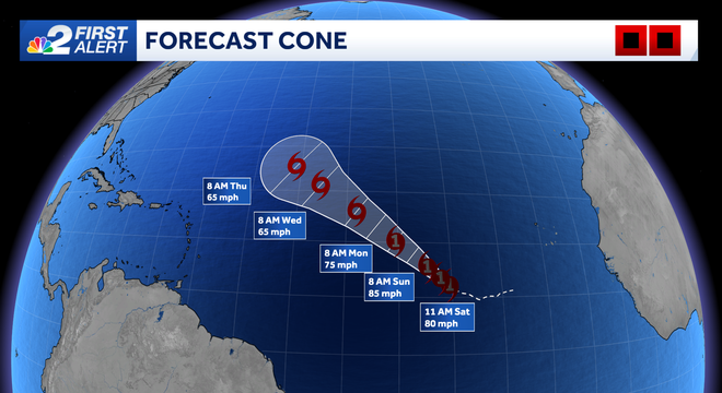
Other than the feature we're watching closely over the Gulf of Mexico, there are two named storm systems in the eastern Atlantic Ocean, Kirk and Leslie.
Thankfully, the steering currents over the ocean are working in our favor and neither of these storms is a threat to the United States.
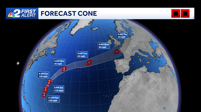
Kirk is tracking northwestward across the open Atlantic and is expected to slowly weaken as it turns north and northeast in the cooler Atlantic waters.
Hurricane Leslie is located southeast of Kirk and also poses no threat to land. Leslie is expected to track west and pull north heading into next week over the open Atlantic.
There is one other area in the far eastern tropical Atlantic that is being monitored for tropical development as a tropical wave is forecast to move off the coast of Africa in the next few days. Chances of development are at 30%.
Download the free NBC2 News app for the latest weather alerts.
Follow the NBC2 weather team on social media
- Chief Meteorologist Allyson Rae on Facebook and X
- Meteorologist Jason Dunning on Facebook and X
- Meteorologist Rob Duns on Facebook and X
- Meteorologist Lauren Hope on Facebook and X
- Meteorologist Jesslyn Ferentz on Facebook and X
Watch our forecasts on TV or online
- Here's where to find our latest video forecast
- You can also watch a livestream of our latest newscast here
DOWNLOAD the free NBC2 News app for your latest news and weather alerts.