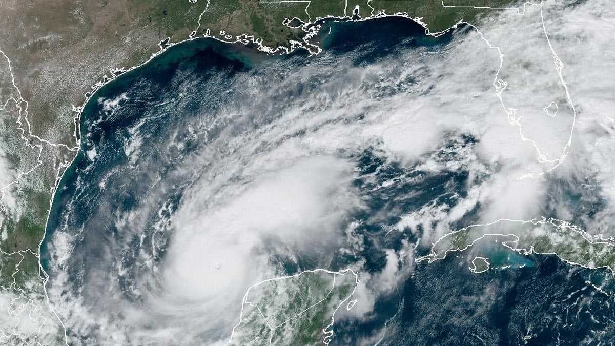
Hurricane Milton's exceptional rate of intensification is the third fastest on record in the North Atlantic and the fastest in the last 17 years, the National Hurricane Center confirms.
As of 10 a.m. Sunday, Milton was just a tropical storm. At noon Monday, Milton was an incredibly powerful Category 5 storm, with winds of 160 mph.
"Thirty-six hours ago, it was a tropical storm. Now we’re talking a Category 5," said Meteorologist Jim Dickey. “If we go through the records, this is now the third-fastest intensifying hurricane on record in the Atlantic. Only Felix and Wilma beat this one out and there’s still some time to go for further intensification here too.”
Wilma was in 2005 and Felix was in 2007. That makes Milton the fastest intensify storm in 17 years.
How did the storm become so strong so quickly? The National Hurricane Center defines rapid intensification is defined as an increase in the maximum sustained winds of a tropical cyclone of at least 35 mph in a 24-hour period.

In order for that rapid intensification to occur, a few ingredients are needed: Very warm sea temperatures, generally over 86 degrees; low wind shear, which means winds don't change speed or direction quickly with height in the atmosphere; and plenty of humid air around.
Milton has nearly tripled the rapid intensification criteria, putting it in a category nearly without precedent.
Milton is now barreling toward Florida, threatening a dangerous storm across much of the state.
A storm surge watch has been issued for coastal Southwest Florida. For coastal Lee and Charlotte counties, 5-10 feet of storm surge is possible. For coastal Collier County, 4-7 feet of storm surge is possible.


