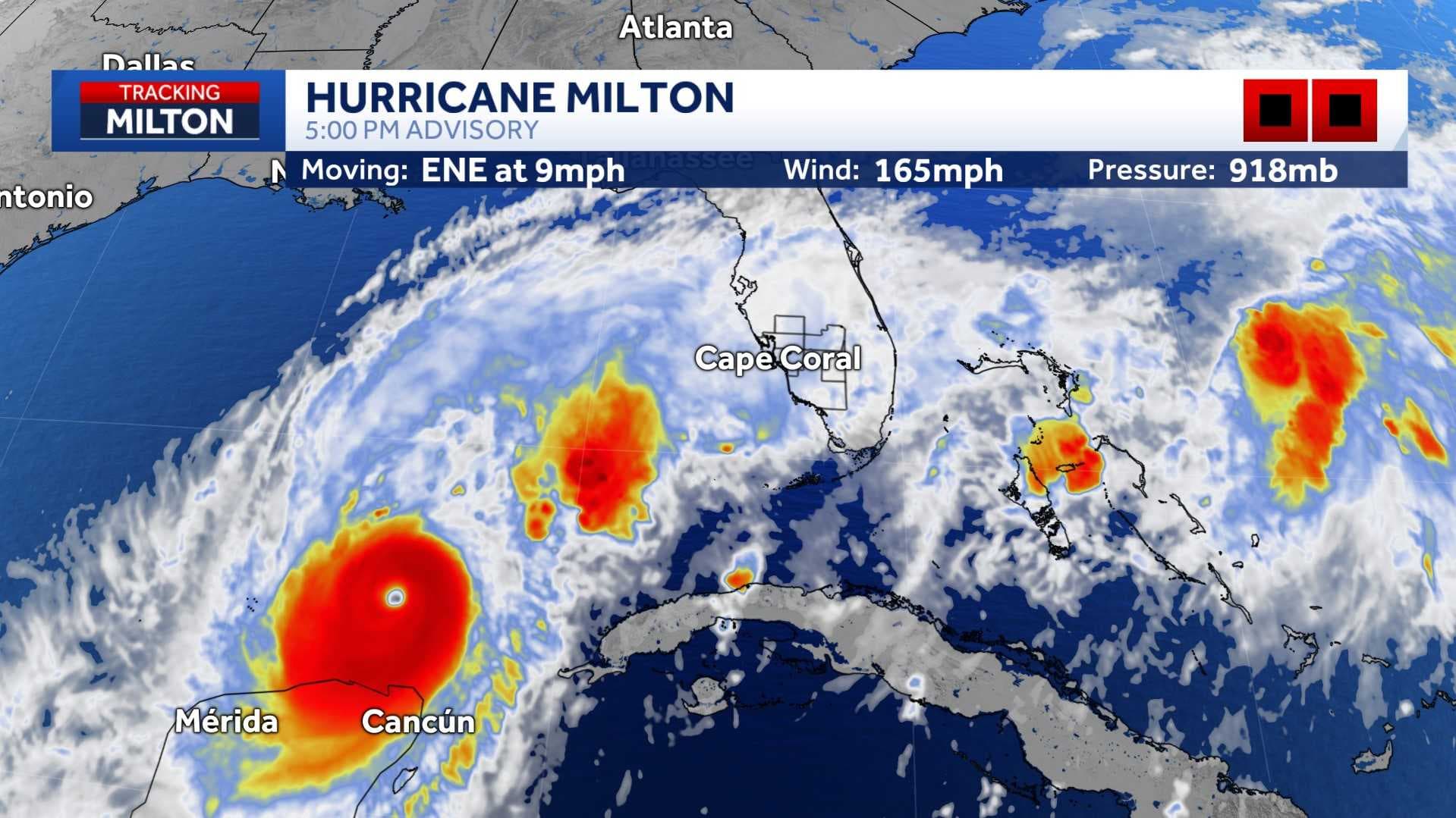
The NBC2 First Alert weather team is tracking major Hurricane Milton in the Gulf as it is expected to make a close approach and bring significant impacts to our area.
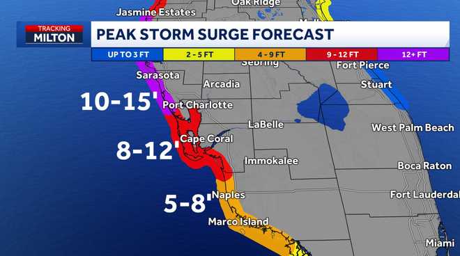
As of the 5 p.m. advisory from the National Hurricane Center (NHC), Milton has become a cat. 5 hurricane again as winds are stronger sustained at 165 mph. As of the newest update, the storm surge amounts have increased for Southwest Florida's coast with up to 12 feet possible for portions along the coast.
Milton's forward speed has not been fluctuating much, moving to the east-northeast at9 mph. The storm's latest pressure reading is lower at 918 mb.
The storm is about 480 miles southwest of Tampa.
The wind field is expected to nearly double in size as the storm nears landfall late Wednesday night into early Thursday morning.
Watches and Warnings
A
storm surge warning
has been issued for coastal Southwest Florida. For coastal Lee and Charlotte counties, 8-12 feet of storm surge is possible. For coastal Collier County, 5-8 feet of storm surge is possible.
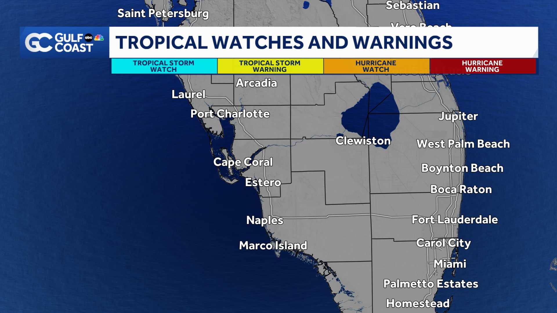
A hurricane warning has been issued for portions of the west coast of Florida including Charlotte, DeSoto, and Lee Counties.
A hurricane watch is still in effect for Collier, Glades, and Hendry Counties.
A Tropical Storm Warning is also in effect for the counties above in the hurricane watch.
A a flood watch has also been issued for our entire community through Thursday morning.
Where is the Storm Going?
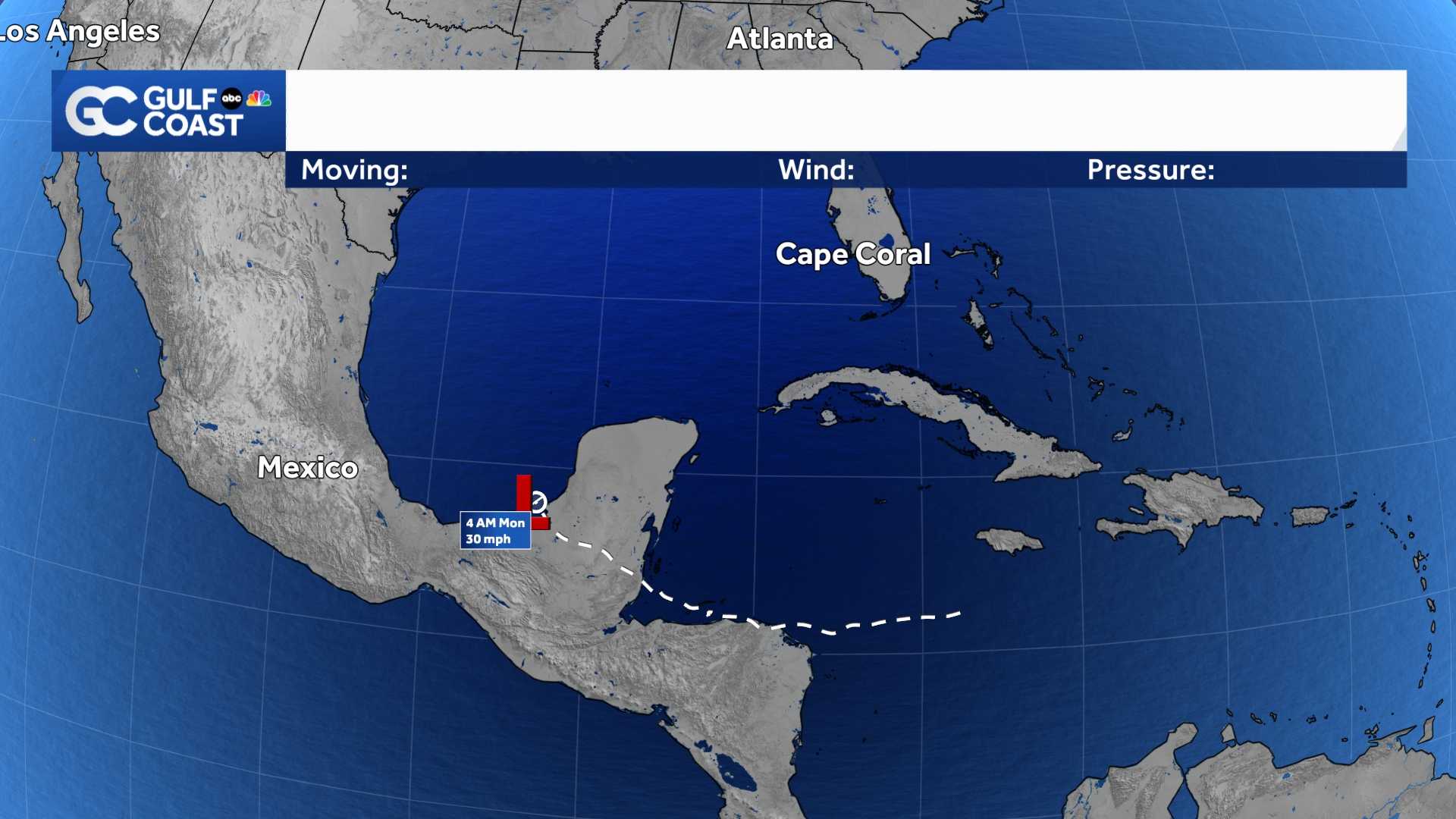
The storm is forecast to approach western Florida as a major hurricane when it makes landfall late Wednesday night or early Thursday morning. As wind shear increases ahead of landfall, the storm is projected to weaken to a Category 3 but regardless, we are still expecting significant, life-threatening impacts.
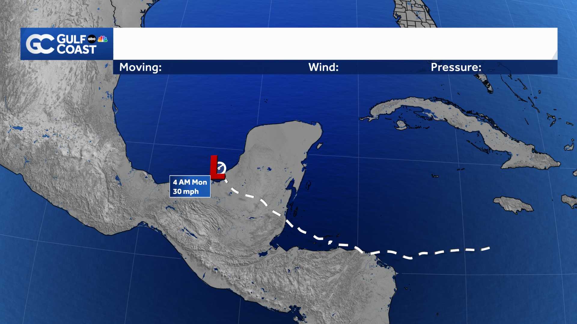
It is important not to focus on the center of the forecast cone. The cone communicates where the center of the hurricane is most likely to be at a certain point in time.
A storm that takes the south side of the cone would bring bigger wind and surge impacts to our area. However, if the storm stays near the center or on the northern side of the cone, it would mean less of a wind threat in our area, and it would keep the risk of storm surge in our community.
Forecast models are showing high consistency in pointing the center of Milton toward Florida, but it is not yet clear what part of the West Coast would most likely see the full force of the expected Category 3 force winds.
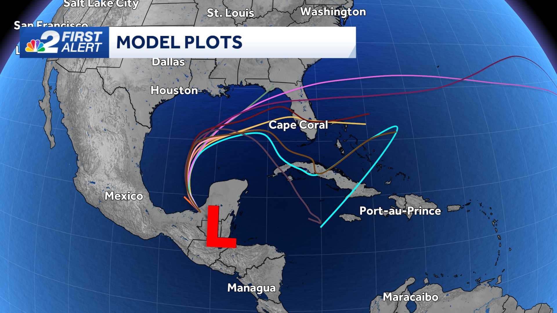
This is why it is better to rely on the forecast cone from the National Hurricane Center as opposed to only looking at forecast model comparisons.
What Impacts Will Happen Where I Live?
The biggest threat to our communities is storm surge. If you are under a mandatory evacuation, you need to evacuate as the water is expected to rise 8-12 feet above ground. This includes coastal Charlotte County and coastal Lee County (including some communities along the Peace River and Caloosahatchee River), as well as coastal Collier County through Vanderbilt Beach. If you live near in these areas— there is the potential for the water to rise over your head.
The wind could gust over 75 mph along Southwest Florida's coast with tropical storm strength winds (below 74 mph) for portions of Hendry and eastern Collier County.
Ahead of any wind or storm surge from Milton, a tropical air mass will be in place over South Florida through Tuesday, boosting our area's rain coverage.
Excessive runoff may result in flooding of rivers, creeks, streams, and other low-lying and flood-prone locations.
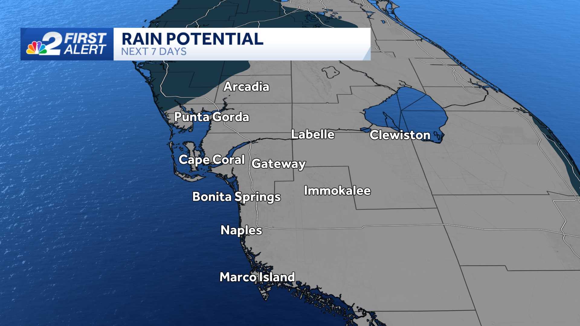
Rainfall totals of 4 to 8+ inches will be possible within the next 7 days.
When Should I Expect Impacts?
Because Milton is in the Gulf of Mexico there will not be a prolonged period of waiting for the storm to get close to our state.
According to the National Hurricane Center, the earliest reasonable arrival time of tropical-storm-force winds is now later, arriving at 8 a.m. Wednesday. This means any outdoor preparation work for the storm should be completed no later than Tuesday evening.
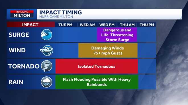
Impacts are forecast to subside Thursday afternoon and evening.
When Should I Come Back Home?
Although conditions will gradually improve on Thursday, if you are able to wait until Friday to come back, please do so. This will allow emergency crews to get on the road and start the clean-up process once it is safe.
Download the free NBC2 News app for the latest weather alerts.
Follow the NBC2 weather team on social media
- Chief Meteorologist Allyson Rae on Facebook and X
- Meteorologist Jason Dunning on Facebook and X
- Meteorologist Rob Duns on Facebook and X
- Meteorologist Lauren Hope on Facebook and X
- Meteorologist Jesslyn Ferentz on Facebook and X
Watch our forecasts on TV or online
- Here's where to find our latest video forecast
- You can also watch a livestream of our latest newscast here
DOWNLOAD the free NBC2 News app for your latest news and weather alerts.