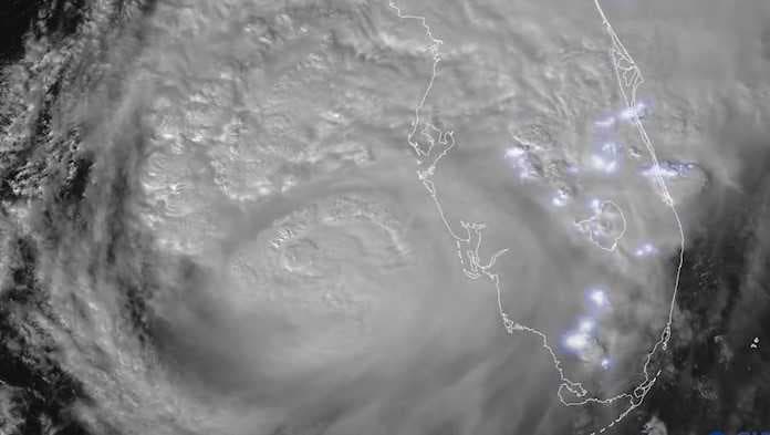
Satellite imagery from the NOAA shows prolific lightning across Florida as the outer bands of Hurricane Milton pummel the state.
NOAA’s GOES East satellite provides new images of Milton’s clouds every 30 seconds. The satellite is orbiting more than 22,000 miles above Earth’s equator, at speeds equal to the Earth’s rotation.
As of 6 p.m. Wednesday, Milton was centered about 50 miles west-southwest of Sarasota, Florida, and had maximum sustained winds of 120 mph, the U.S. National Hurricane Center reported.
Milton's wind field has greatly expanded over the last 24 hours and tropical storm-force winds will be in place across Southwest Florida this evening through late tonight.
Rain bands ahead of the storm have prompted at least five confirmed tornado touchdowns in Southwest Florida. Several neighborhoods in Fort Myers have seen significant damage in neighborhoods across Lee County.


