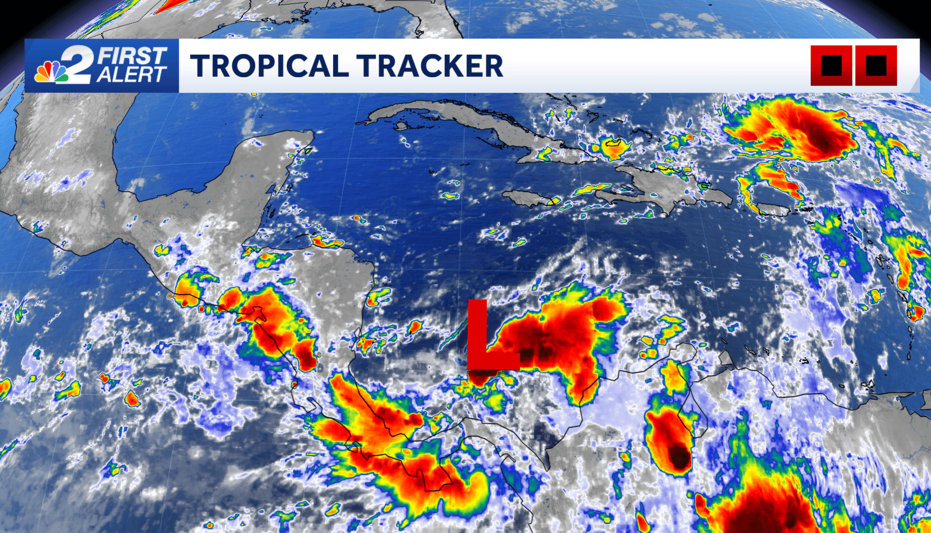
The NBC2 First Alert Hurricane Tracking Team is monitoring the Caribbean Sea this weekend as the likelihood of a tropical system organizing within the next week is high.
As of Sunday afternoon, the National Hurricane Center says that within the region highlighted in red, there's a 90% chance that at least a tropical depression will form in the next 2 days.
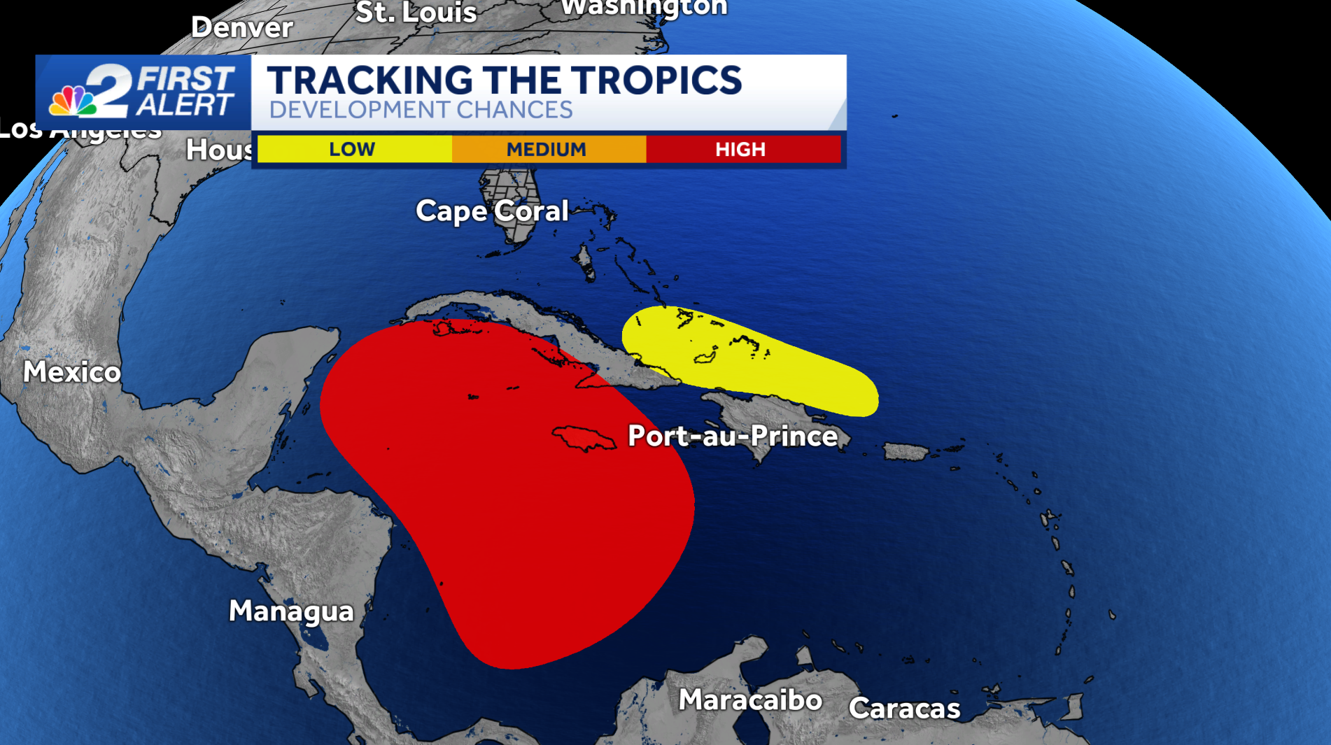
Earlier this weekend, the National Hurricane Center dubbed the area in the southern Caribbean as Invest 97L.
Invest is a shorthand term for "area of investigation". The designation means that tropical weather-specific forecast models can be run on the area of concern, providing us with more forecast model data on where the system may likely go.
The image below shows what those data points look like. Each of the lines presented on the map below offers perspective on where various forecast models think the center of the developing tropical system is likely to move.
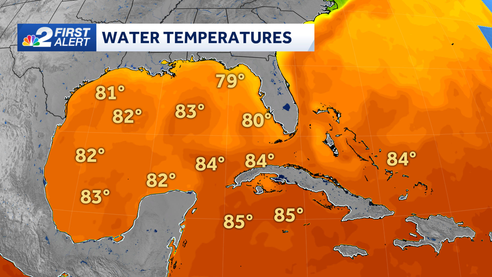
Given that most forecast data points this system toward the Gulf of Mexico it should be noted that the water here is not as primed for tropical development like it was in the lead up to Hurricane Helene and Hurricane Milton.
As seen in the sea surface temperature map below, water temperatures are not as warm as they were in September and October. This means should a storm system enter the Gulf of Mexico, it would not find as suitable of an environment for strengthening like the last two hurricanes to move through this part of the world did.
Given the latest forecast guidance, any storm system that organizes will likely approach or be off the Florida peninsula sometime between Wednesday and Thursday of the upcoming work week.
However, it's too early to determine any specific impacts to our local community.
For now, an increase in rain chances and a more pronounced wind between Wednesday and Thursday is what seems most likely. As the storm system develops and moves, though, we'll be able to get a better idea as to exactly how much of an impact it may have on our state.
DOWNLOAD the free NBC2 News app for your latest news and weather alerts.
Other areas monitored
Another area to its east (highlighted in yellow) is producing widespread showers near the Southeastern Bahamas. While this disturbance is expected to be absorbed by the developing system in the Caribbean, more disturbed weather is expected to form by the middle of the week. Some slow development is possible as it moves west later in the week.
Elsewhere in the tropics, Subtropical Storm Patty organized earlier this weekend over the north Atlantic Ocean.
Patty is expected to become post-tropical Sunday night or early Monday. It will not impact the weather in the United States.
Count on NBC2 to keep you updated as we monitor the developments in the Caribbean this week.
______________________________________________________________________
Follow the NBC2 weather team on social media
- Chief Meteorologist Allyson Rae on Facebook and X
- Meteorologist Jason Dunning on Facebook and X
- Meteorologist Rob Duns on Facebook and X
- Meteorologist Lauren Hope on Facebook and X
- Meteorologist Jesslyn Ferentz on Facebook and X
Watch our forecasts on TV or online