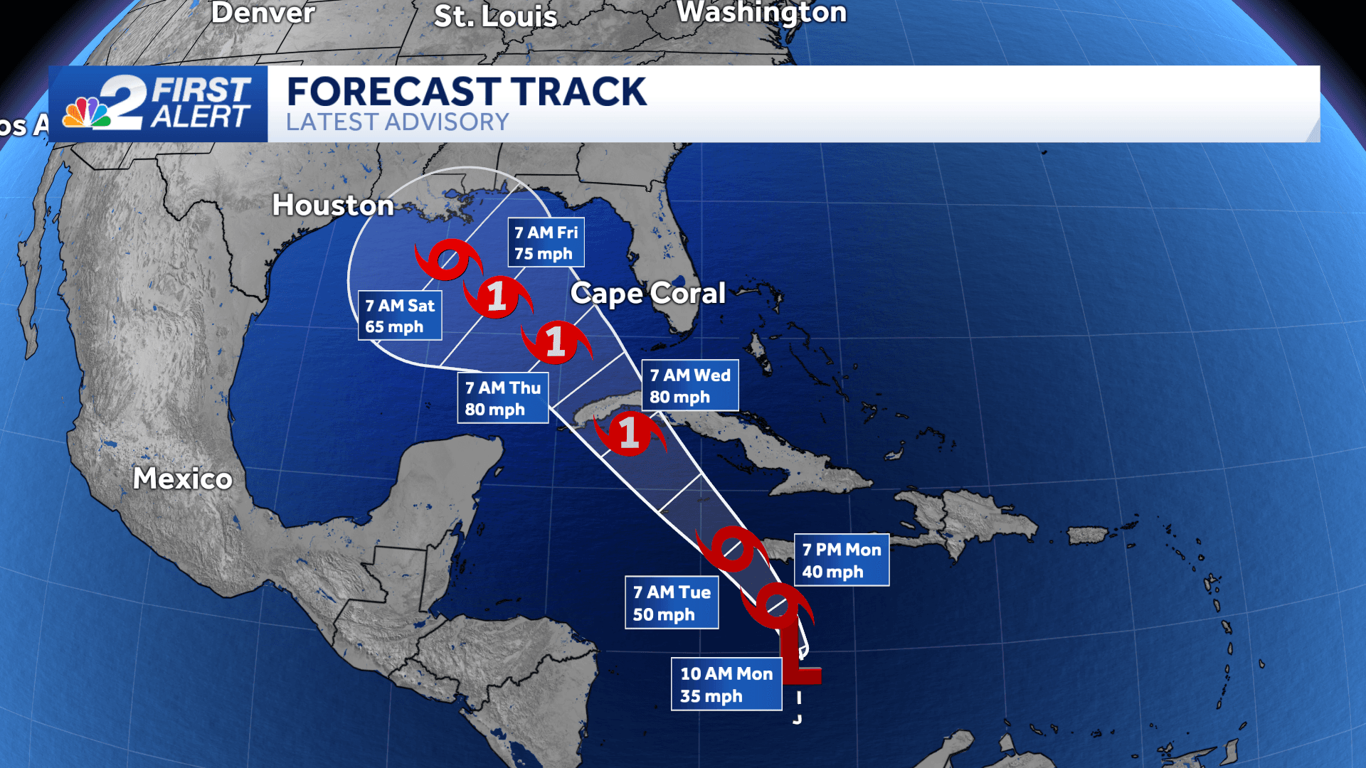
Tropical Depression 18 has formed in the Caribbean Sea Monday morning and is forecast to strengthen as the storm heads north and northwest over the next few days.
T.D. 18 has maximum sustained winds at 35 mph and is moving north at 9 mph.
The system is forecast to become Tropical Storm Rafael as early as Monday afternoon, and the storm could reach hurricane status Tuesday night into Wednesday morning as soon-to-be Rafael approaches western Cuba.
From there, Rafael would move into the southern Gulf of Mexico where it would make its closest approach to Florida, which would most likely be late Wednesday into Thursday morning.
What's important to note though is that unlike recent hurricanes, what will become Hurricane Rafael is not expected to move directly toward the peninsula.
This trend has been consistently reflected in the forecast model data. As seen below, the overwhelming majority of the data shows the system moving into the Gulf toward the northwest on Wednesday and Thursday.
The environment this eventual hurricane will find in the Gulf of Mexico will be very different than what Hurricanes Helene and Milton experienced.
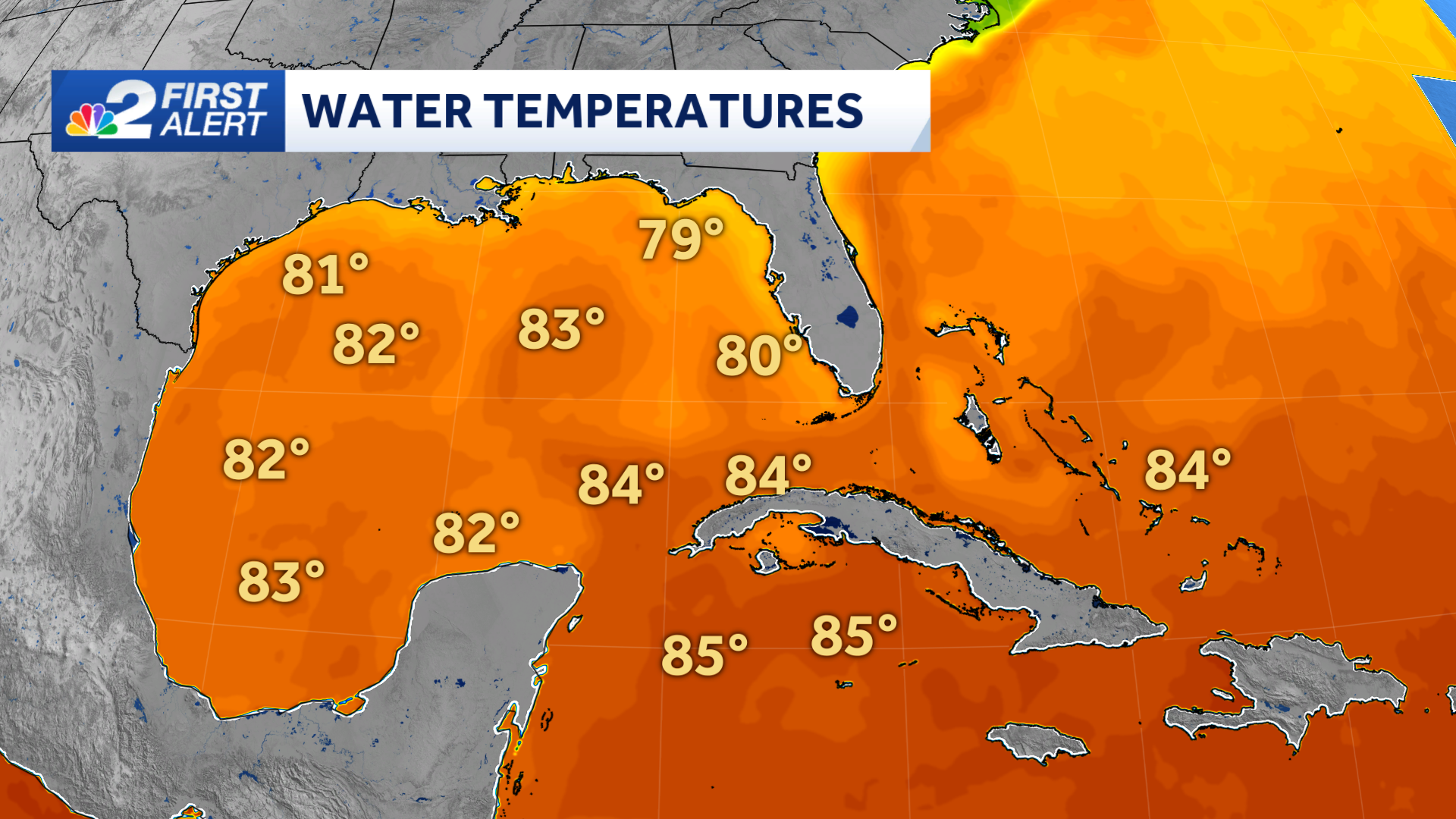
Water temperatures, though warm, are significantly cooler than in September and October. This is important because warm water is what fuels tropical systems. This is a contributing factor as to why the hurricane is forecast to weaken as it moves across the Gulf later this week.
Wind shear is also likely to be much more of an impactful player with Rafael than it was with Hurricanes Helene and Milton.
Wind shear refers to the change in wind speed and direction with height. When it is substantial, it can work against tropical systems by making it difficult for them to remain vertically organized.
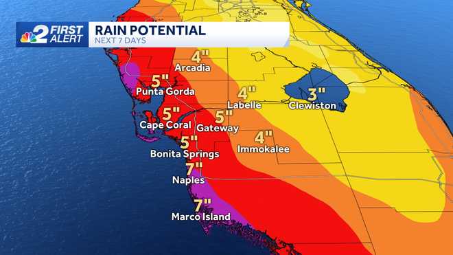
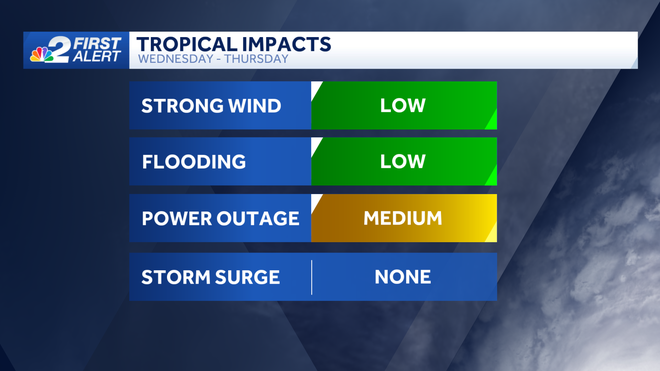
For now, local impacts to Southwest Florida will likely include windier weather (but below sustained tropical storm and hurricane-force wind) on Wednesday and Thursday. We'll also likely see a push of tropical moisture toward the region increasing our community's rain coverage on Wednesday and Thursday as well.
Due to the storm's track away from Florida, winds are forecast to stay offshore, which would prevent any threat of storm surge.
______________________________________________________________________
Follow the NBC2 weather team on social media
- Chief Meteorologist Allyson Rae on Facebook and X
- Meteorologist Jason Dunning on Facebook and X
- Meteorologist Rob Duns on Facebook and X
- Meteorologist Lauren Hope on Facebook and X
- Meteorologist Jesslyn Ferentz on Facebook and X
Watch our forecasts on TV or online