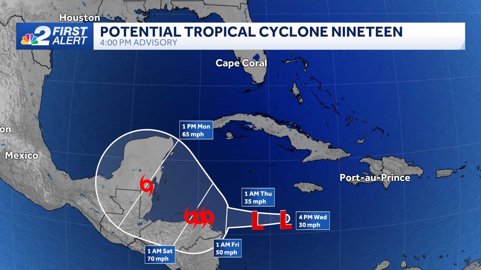
Advisories are now being issued on Potential Tropical Cyclone 19. The NBC2 First Alert Hurricane Tracking team is monitoring the Caribbean Sea for possible development of Tropical Storm Sara in the coming days.
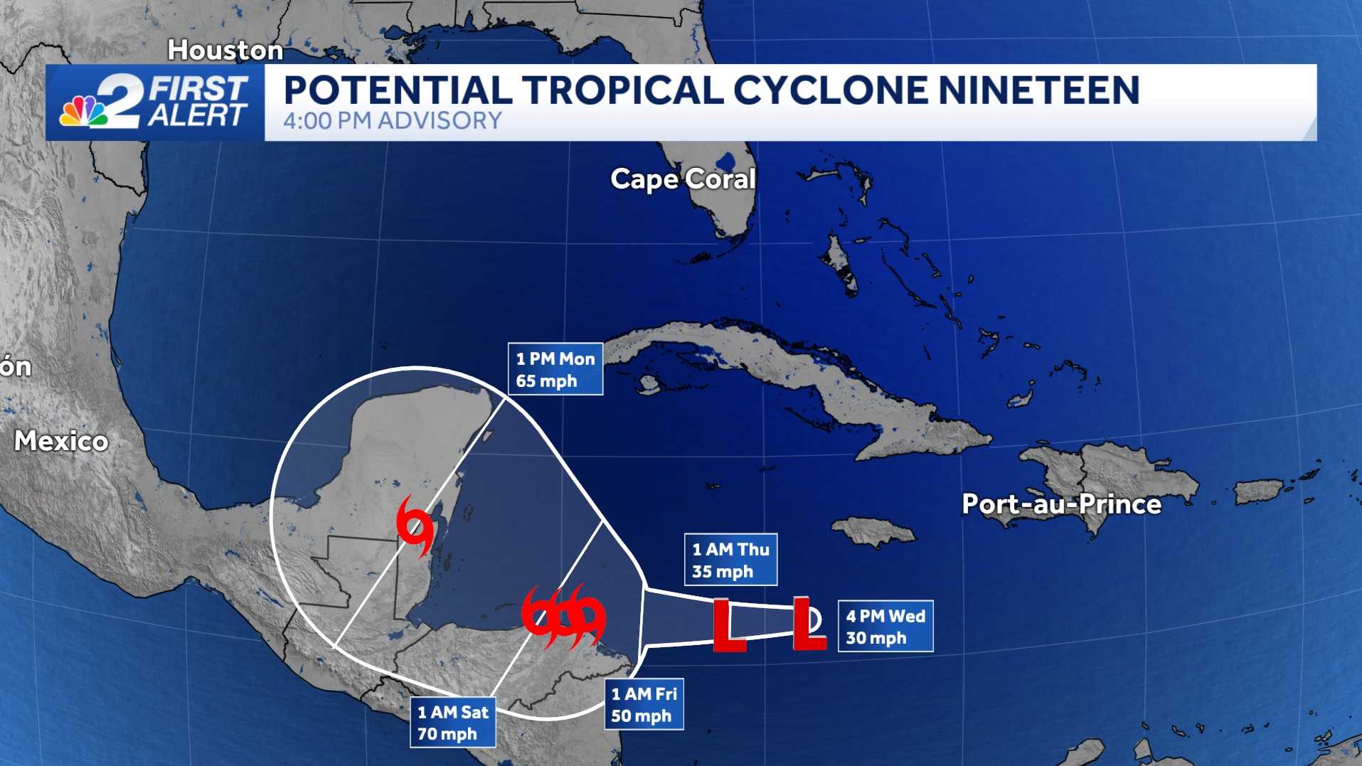
The term Potential Tropical Cyclone refers to a system that isn't yet organized enough to be considered a tropical depression or storm but is forecast to impact land as at least a tropical storm within the next two days.
This is why alerts are going up in Central America as the system drifts westward over the Caribbean.
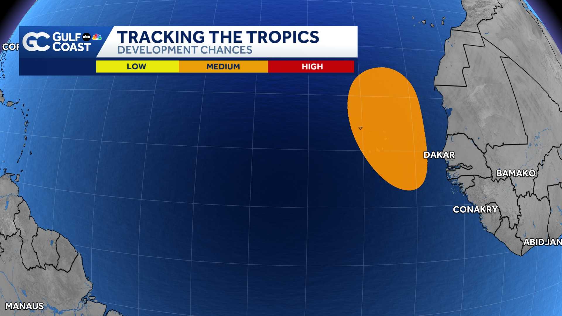
The current forecast calls for this system to become a tropical storm on Friday and remain at tropical storm strength through Monday. Sara is the next name on this year's tropical storm and hurricane naming list.
For now, Florida is not in the cone, but a threat to the Florida Gulf Coast is possible next week.
High pressure building across the northern Gulf this weekend will keep soon-to-be Sara meandering over the western Caribbean through the weekend, and then a dip in the jet stream is forecast to pull the system north or northeast into the Gulf of Mexico by Monday or Tuesday.
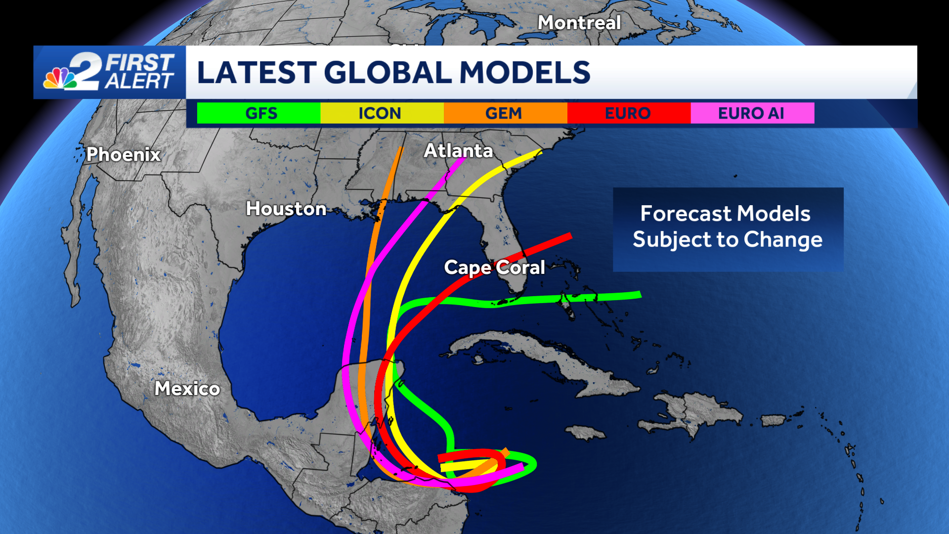
While it's too early to know the exact path the storm could take, the consensus among the computer model forecasts suggests a track toward the Florida Gulf Coast.
It's important to remember that forecast models this far out are subject to larger errors, particularly for storms that haven't developed. We'll have higher confidence in a track once a system forms.
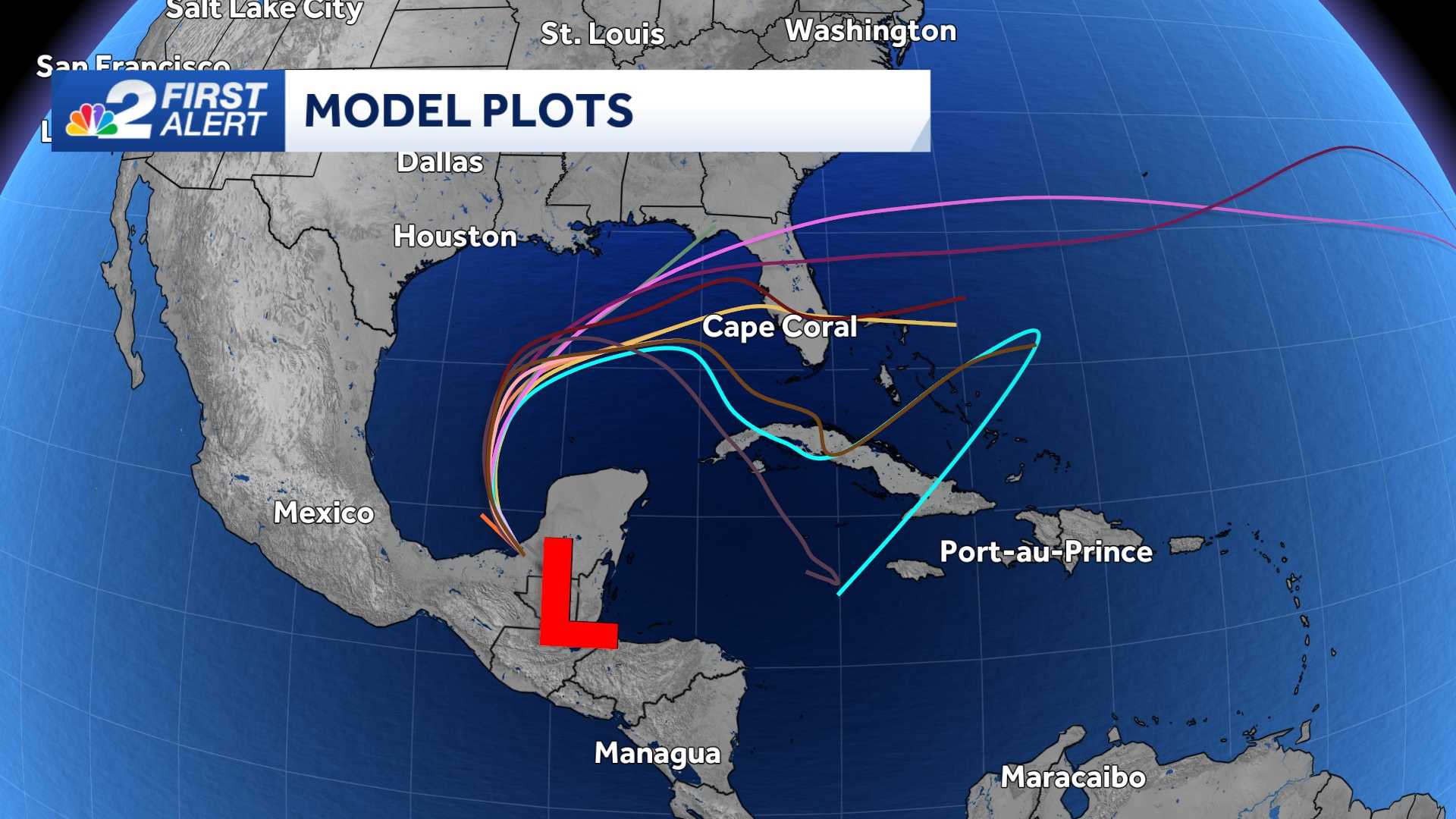
The latest global models, which are usually the most skilled at predicting a potential track, currently show a wide range of possibilities from the panhandle to south Florida.
While it's possible Sara could strengthen into a hurricane, it would be unusual for a major hurricane (category 3 or higher) to move across the Gulf of Mexico this late into the season due to stronger wind shear and cooler water temperatures.
Even though hurricane season is in the process of winding down, it's not unheard of to get impactful storms in the month of November. The most recent ones were Nicole in 2022 and Eta in 2020. Both made landfall in Florida. Since 1851, only one hurricane has made landfall in Florida after November 20, which was Hurricane Kate back in 1985.
At this point, it's too early to know if this storm will bring any major impacts to Southwest Florida, but we should be open to the possibility of a storm threatening any part of the state next week.
The best thing to do now is stay well-informed and plugged into what's happening in the tropics.
Count on the NBC2 First Alert Hurricane Tracking Team to keep you updated.
______________________________________________________________________
Follow the NBC2 weather team on social media
- Chief Meteorologist Allyson Rae on Facebook and X
- Meteorologist Jason Dunning on Facebook and X
- Meteorologist Rob Duns on Facebook and X
- Meteorologist Lauren Hope on Facebook and X
- Meteorologist Jesslyn Ferentz on Facebook and X
Watch our forecasts on TV or online