
Could Florida really see accumulating snow next week?
There's a chance that parts of the Sunshine State could see wintry weather, including accumulating snow, next week.

There's a chance that parts of the Sunshine State could see wintry weather, including accumulating snow, next week.
There's a chance that parts of the Sunshine State could see wintry weather, including accumulating snow, next week.
As you may have heard, some models are hinting at the potential for accumulating snow in Florida next week. But is that even possible?
While it is quite rare, history tells us it can snow in Florida. In fact, as recently as 2018, the state capital, Tallahassee, picked up nearly a quarter of an inch of snow in an early January winter storm. Four years prior, Pensacola recorded nearly 2 inches of snow in late January of 2014.
The record for accumulating snow over a 24-hour period was set in Milton, Florida, back in March of 1954, when an impressive 4 inches of snow fell!
When it does snow in Florida, as the three cases above suggest, it tends to occur in the panhandle, and a number of ingredients need to come together in just the right way for it to happen. There's a chance that those ingredients may very well come together next week.
An arctic air mass will dive southward into the eastern United States Sunday and into early next week, ushered all the way south into Florida by a strong arctic cold front.
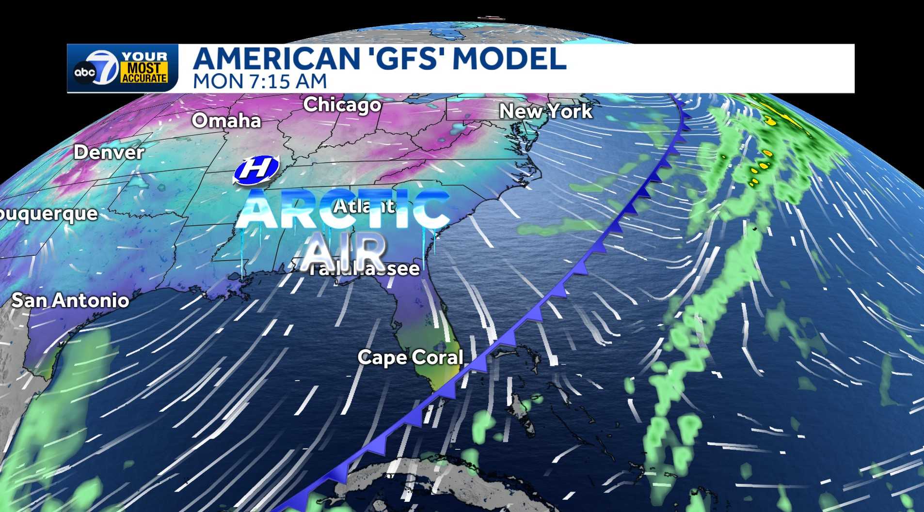
That will set the stage for our potential winter weather event, as a new disturbance will form over the western Gulf Tuesday, spreading rain, ice and snow across the southeastern United States as it tracks eastward through Wednesday. If the storm tracks far enough south, then enough cold air would be in place on the northwest side of it for a band of accumulating snow to set up over northern Florida.
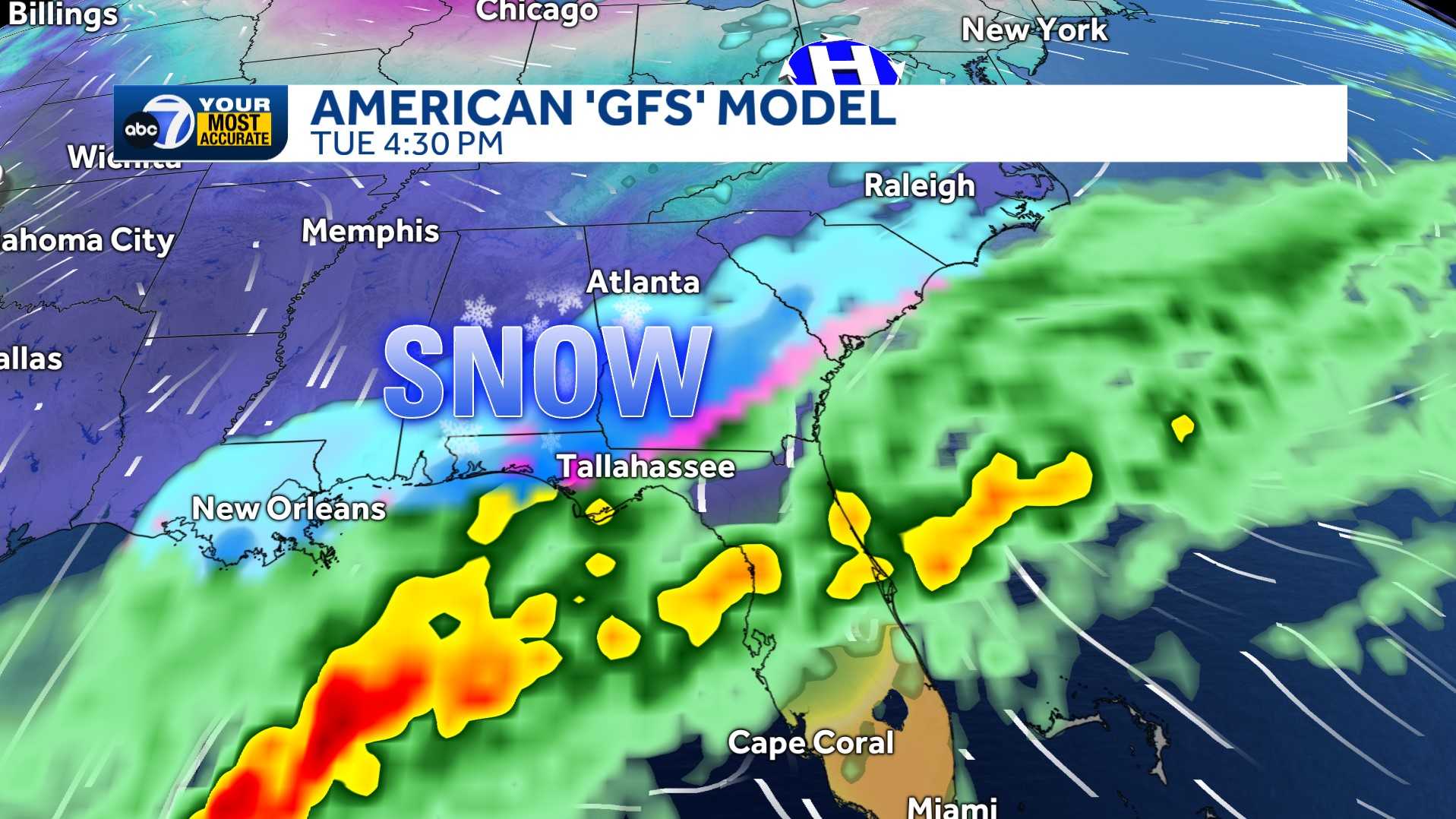
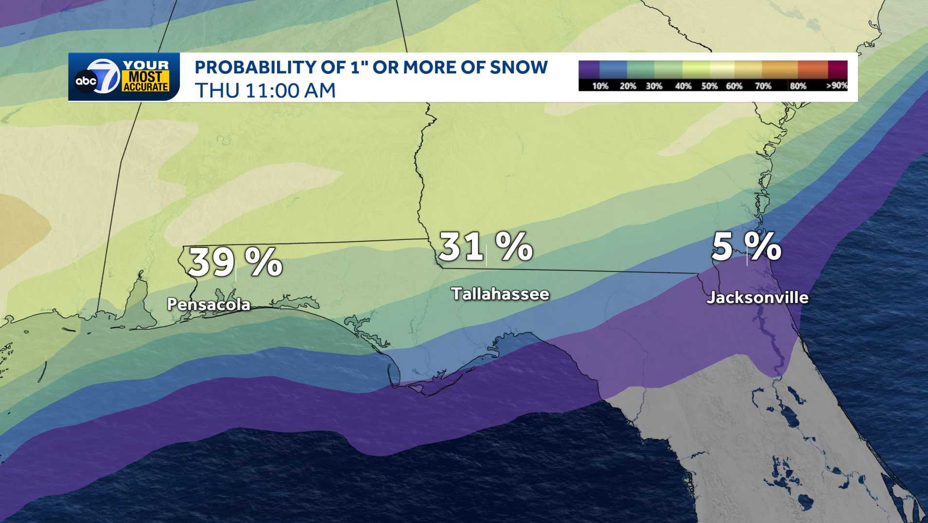
As of this writing, the ensemble of the European forecast model shows a 30-40% chance for an inch or more of snow to fall along and north of I-10 in northwest Florida, from Tallahassee west to Pensacola!
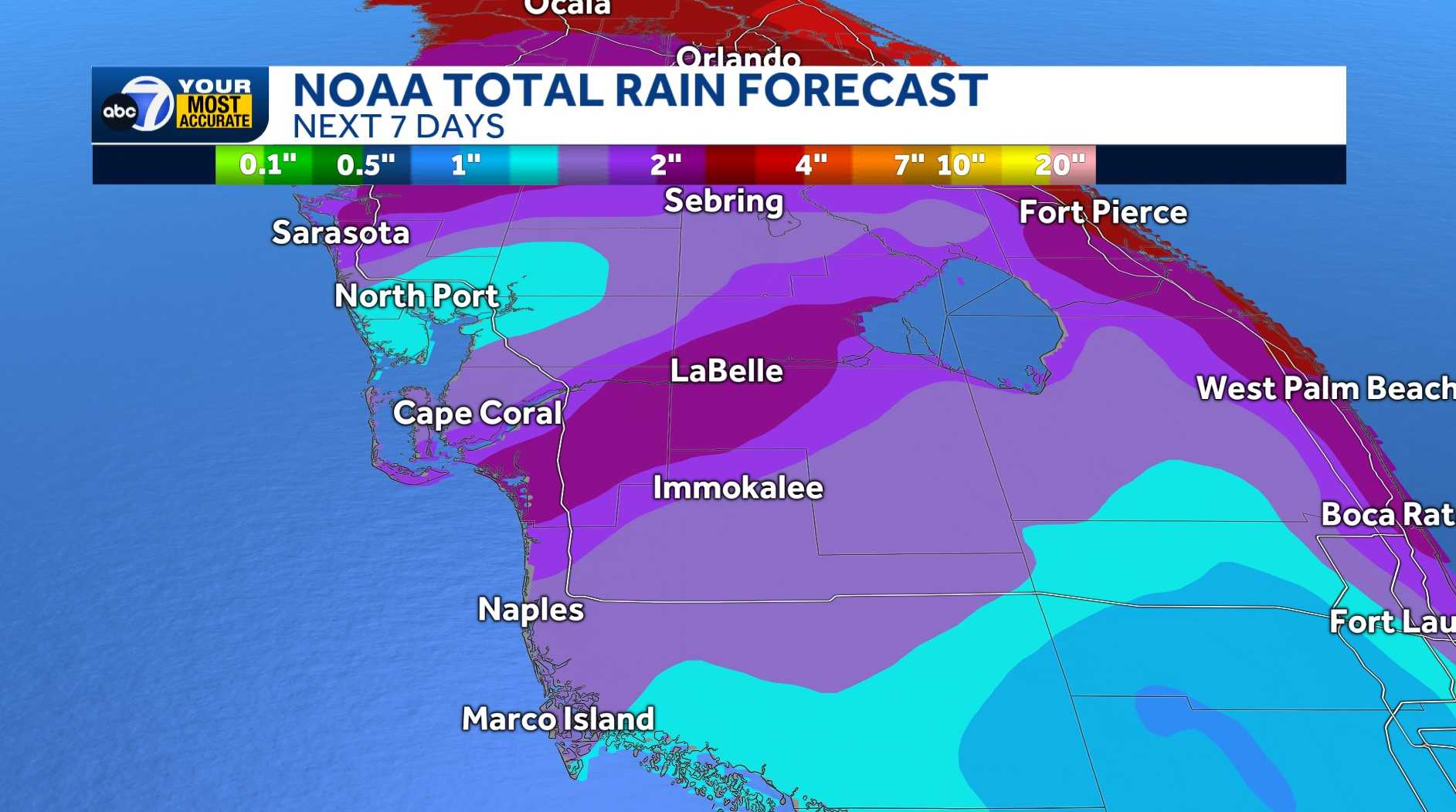
Locally, it will be much too warm for any frozen precipitation, but this storm system does look like it will bring soaking rain to the area. Including the rain we see from Sunday’s cold front, the NWS shows a broad 1-3 inches of rain falling. For context, Fort Myers only averages 2.43 inches of rain for the entire month of January.
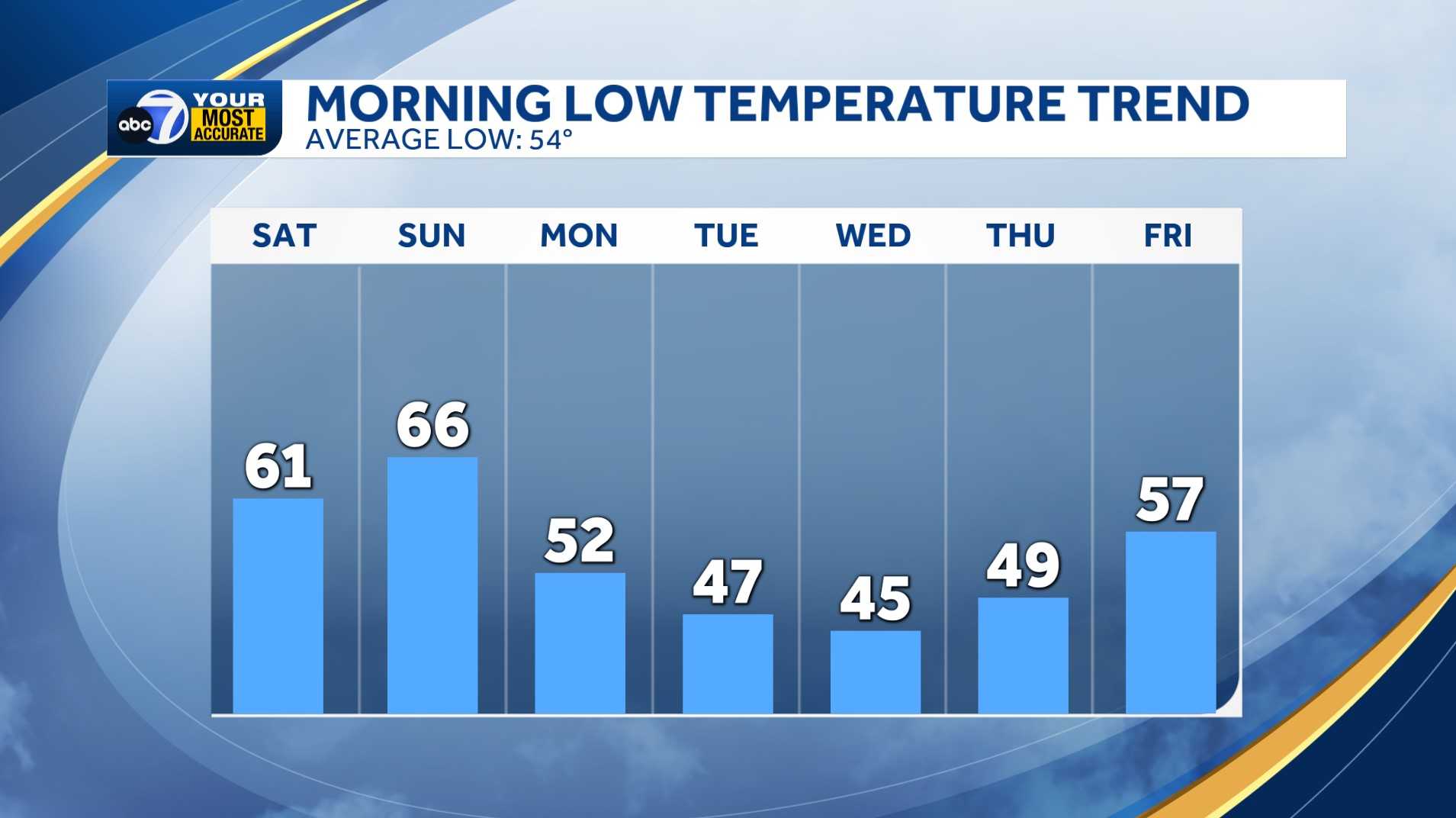
Also, while it won’t be cold enough for snow, it is going to turn pretty chilly locally, too. While the clouds and rain will keep the truly cold air from reaching us, highs will be back in the 60s, with morning lows back in the 40s next week, rivaling some of the coldest mornings we’ve had this season.
Stick with ABC7 as we continue to track the rain, chilly weather, and the threat for snow and ice in northern Florida next week.