Storm surge inundation flooding peaked nearly 10 feet above ground level near Manasota Key during Hurricane Milton's landfall in October 2024.
That's one of the most impactful statistics relevant to our part of the Gulf Coast listed in the National Hurricane Center Tropical Cyclone Report released on Monday.
The NHC generates comprehensive reports on all tropical systems that form in the Atlantic basin. Because of the enormity of the details and specifics provided in each report, they often take months to complete.
You can view the entire report here .
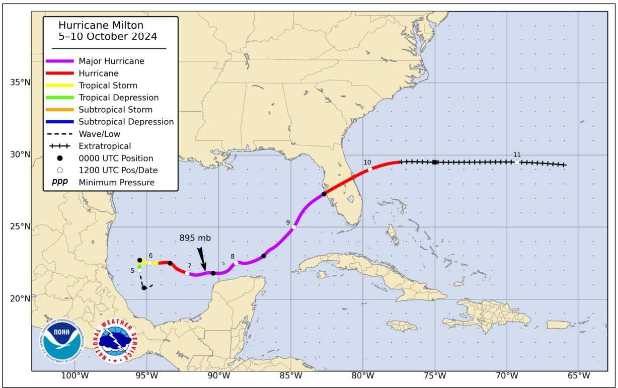
Though Milton made landfall on Florida's west coast as a category 3, when over the open water of the Gulf north of Mexico's Yucatán Peninsula, the storm was for a time one of the strongest hurricanes ever observed in the Atlantic basin.
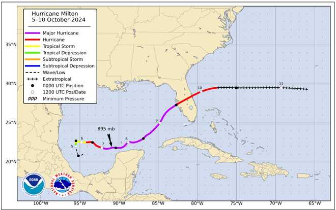
The map below, included in the NHC report, shows Milton's track positions. The line segments in purple show where the storm was at major hurricane status.
Major hurricane status refers to the time the system was at least a category 3.
The biggest impacts Hurricane Milton brought to the Gulf Coast of South Florida were storm surge inundation flooding and long-track tornadoes.
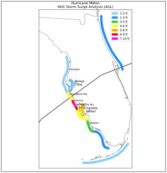
Storm surge inundation refers to salt water from the Gulf flooding what is normally dry ground. It is expressed in feet above ground level, abbreviated at times in the report as "AGL".
According to the National Hurricane Center, above-ground level storm surge flooding was between 6 and 9 feet from Venice to Boca Grande.
The map below, produced by the NHC, shows the surge of flooding from the storm. The graphic's headline "NHC Storm Surge Analysis (AGL)" means how deep the flood water was above ground level.
The black line on the map shows where the eye of the storm went, highlighting the fact that storm surge impacts are worst away from the landfall point, in this case, southward along the coastline.
According to the NHC report, Milton produced 45 tornadoes and one waterspout over Lake Okeechobee.
Five of the tornadoes hit Lee and Charlotte Counties. Of the touchdowns in those counties, 1 was listed as being EF-2 intensity, 2 were listed as being EF-1, and 2 were listed as being EF-0 intensity.
The larger tornadoes in South Florida touched down inland of Interstate 75 near Lake Okeechobee. Several others impacted areas north of the lake and along the Atlantic Coast of Florida.
You can read the National Hurricane Center tropical cyclone reports for all of the storms from last hurricane season here .
Follow the Gulf Coast Storm Team on social media
- Chief Meteorologist Allyson Rae on Facebook and X
- Meteorologist Jim Dickey on Facebook and X
- Meteorologist Jason Dunning on Facebook and X
- Meteorologist Rob Duns on Facebook
- Meteorologist Jesslyn Ferentz on Facebook and X
- Meteorologist Lauren Hope on Facebook and X
- Meteorologist Raphael Tavernier on Facebook and X
Watch your Gulf Coast Weather forecasts on TV or online
- Here's where to find our latest video forecast
- You can also watch a live stream of our latest newscast here
DOWNLOAD the free Gulf Coast News app for your latest breaking news and weather alerts.