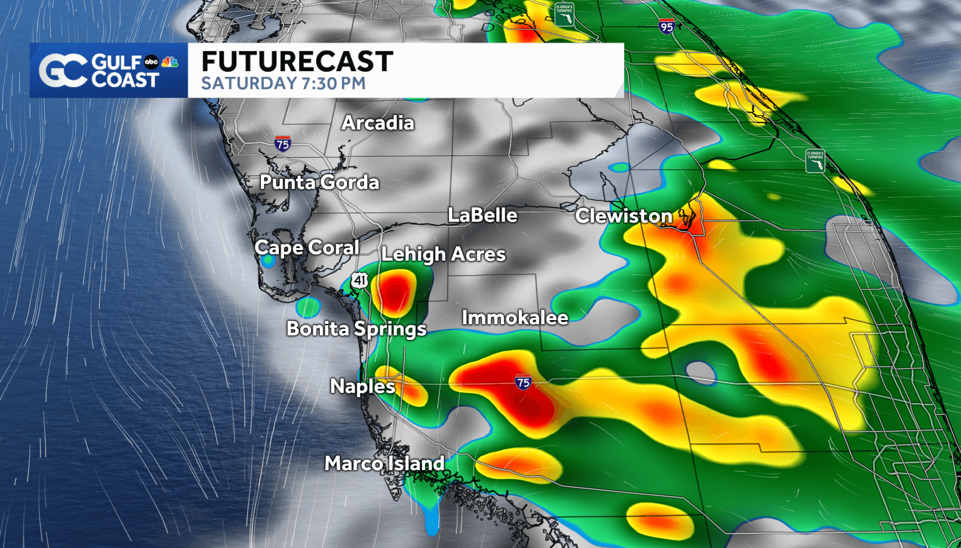
Isolated, strong thunderstorms will be possible in our community this weekend.
The strongest storms that form will likely be along and to the east of the Interstate 75 corridor. In places where they form, frequent lightning, hail and gusty winds will be the main impacts.
As is typical with afternoon sea breeze storms along South Florida's Gulf Coast, the timing of any storms will be after the lunch hour. Inland areas east of Interstate 75 can expect the strongest storms that form to develop mainly between 2 and 5 p.m.
For coastal areas west of Interstate 75 in Lee, Collier and Charlotte, the chance of storms is lower.
On days when the sea breeze fires up the widest coverage of storms east of the interstate, coastal areas often see considerably less rain. However, as we move past 5 p.m., it will be possible for storm outflow boundaries to pull some rain and storms back toward the Gulf.
With this in mind, coastal areas of our community will have their best chance of any rain later in the day, after 5 p.m.
Gulf Coast News viewers in Lehigh Acres reported seeing hail as storms moved through the community.
Be sure to have the Gulf Coast News App downloaded onto your phone for Gulf Coast Live Radar and weather alerts as they are issued.
______________________________________________________________________
Follow the Gulf Coast Storm Team on social media
- Chief meteorologist Allyson Rae on Facebook and X
- Meteorologist Jim Dickey on Facebook and X
- Meteorologist Jason Dunning on Facebook and X
- Meteorologist Rob Duns on Facebook and X
- Meteorologist Jesslyn Ferentz on Facebook and X
- Meteorologist Lauren Hope on Facebook and X
- Meteorologist Raphael Tavernier on Facebook and X
Watch your Gulf Coast Weather forecasts on TV or online
- Here's where to find our latest video forecast
- You can also watch our newscasts live or on demand here
DOWNLOAD the free Gulf Coast News app for your latest news and alerts on breaking news, weather, sports, entertainment and more.