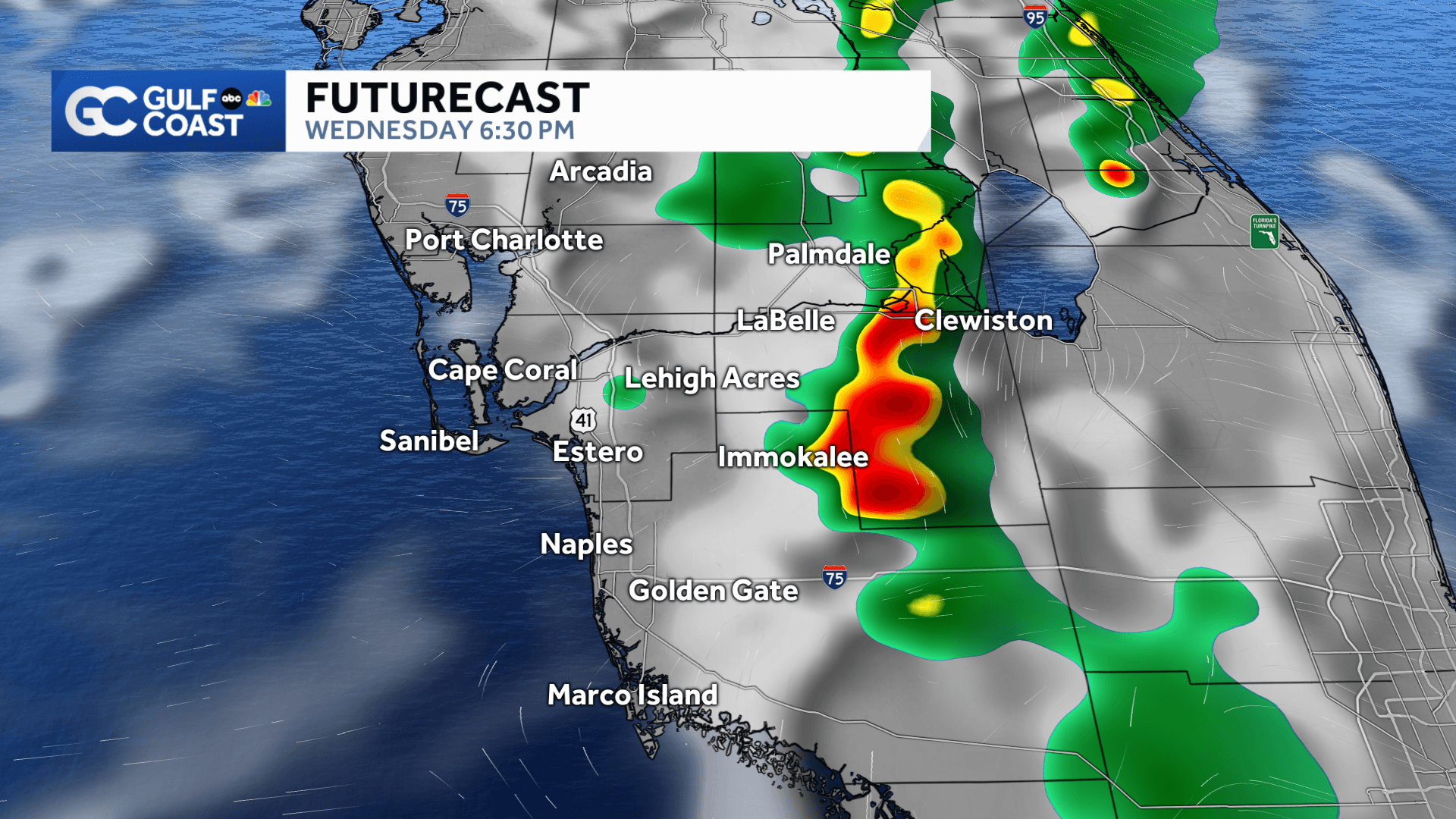
We'll track another round of afternoon storms across the Gulf Coast Wednesday, but once again, the rain will tend to favor our inland areas.
Showers and storms will start flaring up after 1-2 p.m. for locations near I-75, but as the Gulf Coast sea breeze migrates inland, the stormy weather will build east toward Lake Okeechobee. The main threats will be heavy rain and frequent lightning.
Tonight, storms will wind down for a while after sunset, with lows dropping into the mid-to-upper 70s.
The next change in the weather pattern comes this weekend as we track an approaching front, which could bring higher rain chances for our coastal counties. Highs will stay in the upper 80s to low 90s over the next week.
Be sure to have the Gulf Coast News App downloaded onto your phone for Gulf Coast Live Radar and weather alerts as they are issued.
______________________________________________________________________
Follow the Gulf Coast Storm Team on social media
- Chief Meteorologist Allyson Rae on Facebook and X
- Meteorologist Jim Dickey on Facebook and X
- Meteorologist Jason Dunning on Facebook and X
- Meteorologist Rob Duns on Facebook and X
- Meteorologist Jesslyn Ferentz on Facebook and X
- Meteorologist Lauren Hope on Facebook and X
- Meteorologist Raphael Tavernier on Facebook and X
Watch your Gulf Coast Weather forecasts on TV or online
- Here's where to find our latest video forecast
- You can also watch our newscasts live or on demand here
DOWNLOAD the free Gulf Coast News app for your latest news and alerts on breaking news, weather, sports, entertainment and more.