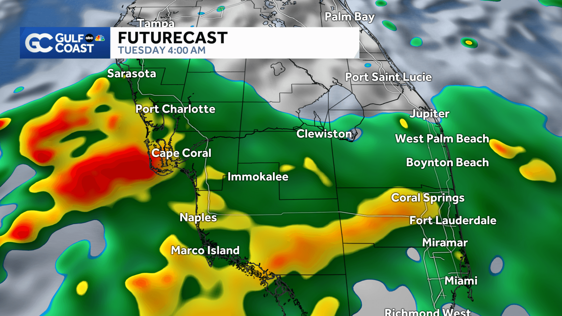
We're in store for more rounds of rain and storms across Southwest Florida Tuesday, and the wetter weather looks to stick around through Wednesday.
Today and Wednesday are Gulf Coast Weather Impact Days since some of the heavier bands of rain could lead to localized flooding.
The threat for severe weather will stay low Tuesday, but some of today's storms could produce some intense lightning at times.
A Flood Watch is in place for Collier County through Wednesday morning, highlighting the potential for more flooding rain.
Over the next three days, rain accumulations could add up to 1 to 3 inches.
Meanwhile, off Florida's East Coast, there is a broad low-pressure system ; however, it has a low chance for tropical development as we enter the first week of hurricane season.
Your Gulf Coast Weather Team will keep an eye out on the tropics all season long and will inform you if something begins to form.

Send your weather pictures and videos to tips@gulfcoastnewsnow.com .
Follow the Gulf Coast Storm Team on social media
- Chief Meteorologist Allyson Rae on Facebook and X
- Meteorologist Jim Dickey on Facebook and X
- Meteorologist Jason Dunning on Facebook and X
- Meteorologist Rob Duns on Facebook and X
- Meteorologist Jesslyn Ferentz on Facebook and X
- Meteorologist Lauren Hope on Facebook and X
- Meteorologist Raphael Tavernier on Facebook and X
Watch your Gulf Coast Weather forecasts on TV or online
- Here's where to find our latest video forecast
- You can also watch our newscasts live or on demand here
DOWNLOAD the free Gulf Coast News app for your latest news and alerts on breaking news, weather, sports, entertainment and more.