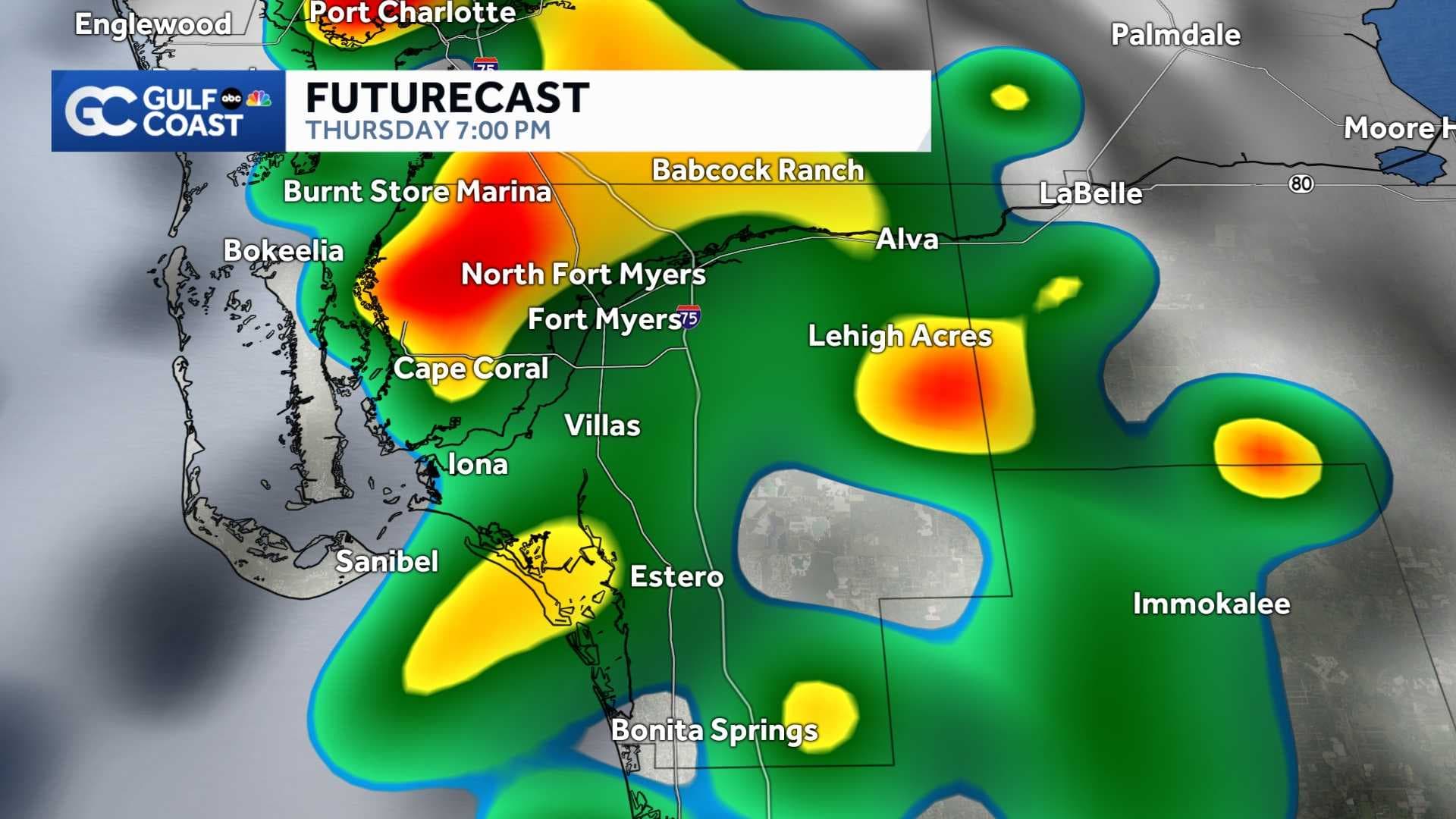
A Gulf Coast Weather Impact Day is active this evening and tomorrow as showers and thunderstorms are forecast in areas along and west of Interstate 75.
Though widespread severe weather isn't expected, storms that do form during this 2-day period will be most impactful between 2 and 7 p.m.
Interactive Gulf Coast Live Radar
The reason our coastal zones are the favored areas for rain and storms tonight and tomorrow is because of the steering winds hailing from the east and southeast. When this happens our Gulf sea breeze normally gets stuck fairly close to US41 and I-75, firing up the widest coverage of rain and storms across western Lee, western Collier and western Charlotte Counties.
Rain chances will begin to fall as we finish the week. We'll still have some storms along the sea breeze on Friday, Saturday and Father's Day Sunday, but because a piece of the Saharan Air Layer will be nearby, the coverage of rain will be lower than what's expected tonight and tomorrow.
_____________________________________________________________________
Follow the Gulf Coast Storm Team on social media
- Chief Meteorologist Allyson Rae on Facebook and X
- Meteorologist Jim Dickey on Facebook and X
- Meteorologist Jason Dunning on Facebook and X
- Meteorologist Rob Duns on Facebook and X
- Meteorologist Jesslyn Ferentz on Facebook and X
- Meteorologist Lauren Hope on Facebook and X
- Meteorologist Raphael Tavernier on Facebook and X
Watch your Gulf Coast Weather forecasts on TV or online
- Here's where to find our latest video forecast
- You can also watch a live stream of our latest newscast here
DOWNLOAD the free Gulf Coast News app for your latest news and alerts on breaking news, weather, sports, entertainment, and more.