Fox4Now
Could July 4th plans be rained out?
Fox4Now Staff
•7/3/2025
Source: Fox4Now
UPDATE THURSDAY, JULY 3, 2025:
A frontal boundary has stalled and is weakening off the southeast U.S. coast. An area of low pressure is starting to develop from the weakening front over the Atlantic waters off the coast of Jacksonville. Some gradual development could occur this weekend with a depression forming. The National Hurricane Center currently has a 50% chance of tropical development.

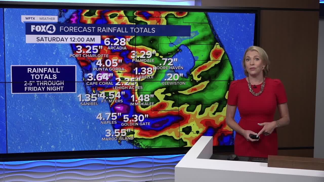
Regardless of tropical development, heavy rainfall is likely across Southwest Florida. The Weather Prediction Center has placed our area in a threat for Excessive Rainfall for Thursday through Saturday. 2-5" totals will be widespread with isolated higher amounts possible through Saturday.


While we are tracking rounds of heavy rain, the latest guidance is showing storm activity back off Friday evening. This means fireworks displays might be damp, but should go on.

___________________________________________________________________________________________________________
UPDATE WEDNESDAY, JULY 2, 2025:
A frontal boundary is expected to stall and weaken off the southeast U.S. coast late this week. An area of low pressure could develop from the weakening front by the weekend over the Atlantic waters off the southeast U.S., over Florida, or over the eastern Gulf. Some gradual tropical or subtropical development could occur thereafter as the low drifts slowly. The National Hurricane Center currently has a 40% chance of tropical development.
Regardless of tropical development, heavy rainfall is likely across Southwest Florida. The Weather Prediction Center has placed our area in a threat for Excessive Rainfall for Thursday through Saturday. 2-5" totals will be widespread with isolated higher amounts possible through Saturday.


If and where an area of low pressure develops will determine how much rainfall SWFL receives and how long it may affect the area.
___________________________________________________________________________________________________________
TUESDAY, JULY 1, 2025:
A frontal boundary is expected to stall and weaken off the southeast U.S. coast late this week. An area of low pressure could develop from the weakening front by the weekend over the Atlantic waters off the southeast U.S., over Florida, or over the eastern Gulf. Some gradual tropical or subtropical development could occur thereafter as the low drifts slowly.
EXCESSIVE RAINFALL OUTLOOK: Heavy rain will be a possibility on Friday, July 4th. This, obviously, could impact some holiday plans. Where the low develops in association with a decaying front in N FL will determine how much rain we see in SWFL and its impacts. Stay tuned! #flwx pic.twitter.com/b1sbLpT4Xh
— Katie Walls, CCM, CBM (@KatieWallsTV) July 1, 2025
Regardless of development, heavy rainfall is possible across the Southeast, including Southwest Florida. The Weather Prediction Center has placed our area in a threat for Excessive Rainfall on Thursday, July 3 and Friday, July 4.
Here are snapshots of the European model's forecast, showing rainfall possibilities at 8 a.m., 3 p.m. and 8 p.m. on Friday, July 4.
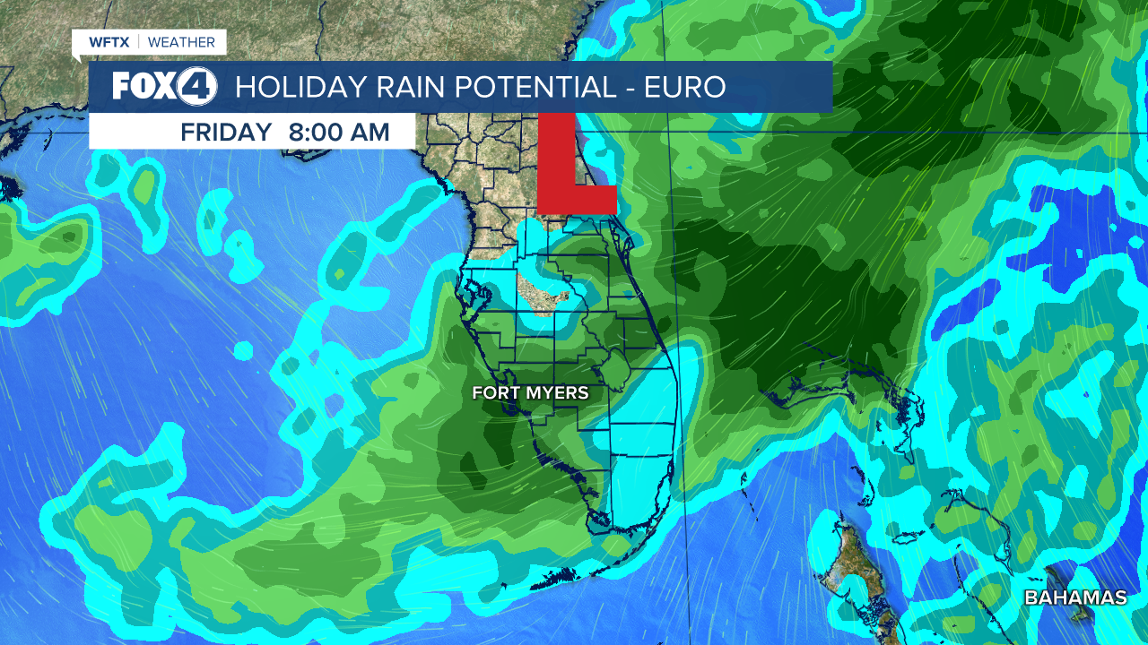
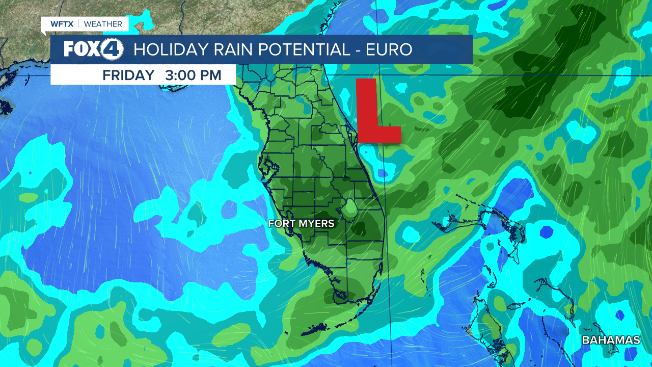
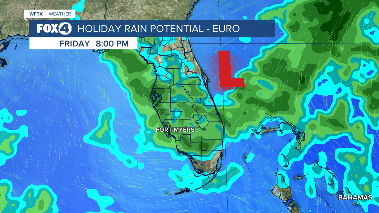
If and where an area of low pressure develops will determine how much rainfall SWFL receives and how long it may affect the area.
We will continue to update the forecast as new data arrive. For now, if you have outdoor plans, be prepare to pivot.
Share: