Fox4Now
TRACKING THE TROPICS: Depression could form next week
Fox4Now Staff
•9/12/2025
Source: Fox4Now
September 10th marked the peak of hurricane season. But, conditions have been abnormally quiet since August 28, when Tropical Storm Fernand dissipated over the open waters of the Atlantic Ocean.

The reason behind the quiet conditions? Strong wind shear over the Atlantic. Strong winds above us help to rip apart storms. That was the main factor behind why Invest 91L, an area that had a high chance of development last week, dissipated over the weekend.
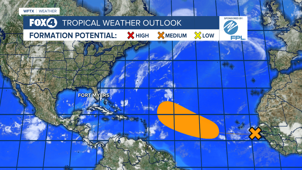
The National Hurricane Center is monitoring a tropical wave located near the west coast of Africa over the far eastern Atlantic. Dry and stable air will likely limit this system's development over the next few days, but a tropical depression could form by the middle to latter part of next week while moving west-northwestward at 10 to 15 mph over the central tropical Atlantic.

Looking beyond the next 7-days, wind shear will be lessening, and the Atlantic is expected to become more active.

The Climate Prediction Center Tropical Hazards Outlook issued on Tuesday predicts where development is possible between September 17-23. Tropical formation is moderate in the Atlantic during this time frame.
The Caribbean and Gulf tend to become more active during the second half of September and first half of October. The CPC Tropical Hazards Outlook includes the potential for development in the northwest Caribbean Sea and southern Gulf near the Yucatan and Bay of Campeche during the time frame of September 17-23. We'll be watching!

Share: