Fox4Now
Development possible near Florida this weekend?
Fox4Now Staff
•10/2/2025
Source: Fox4Now
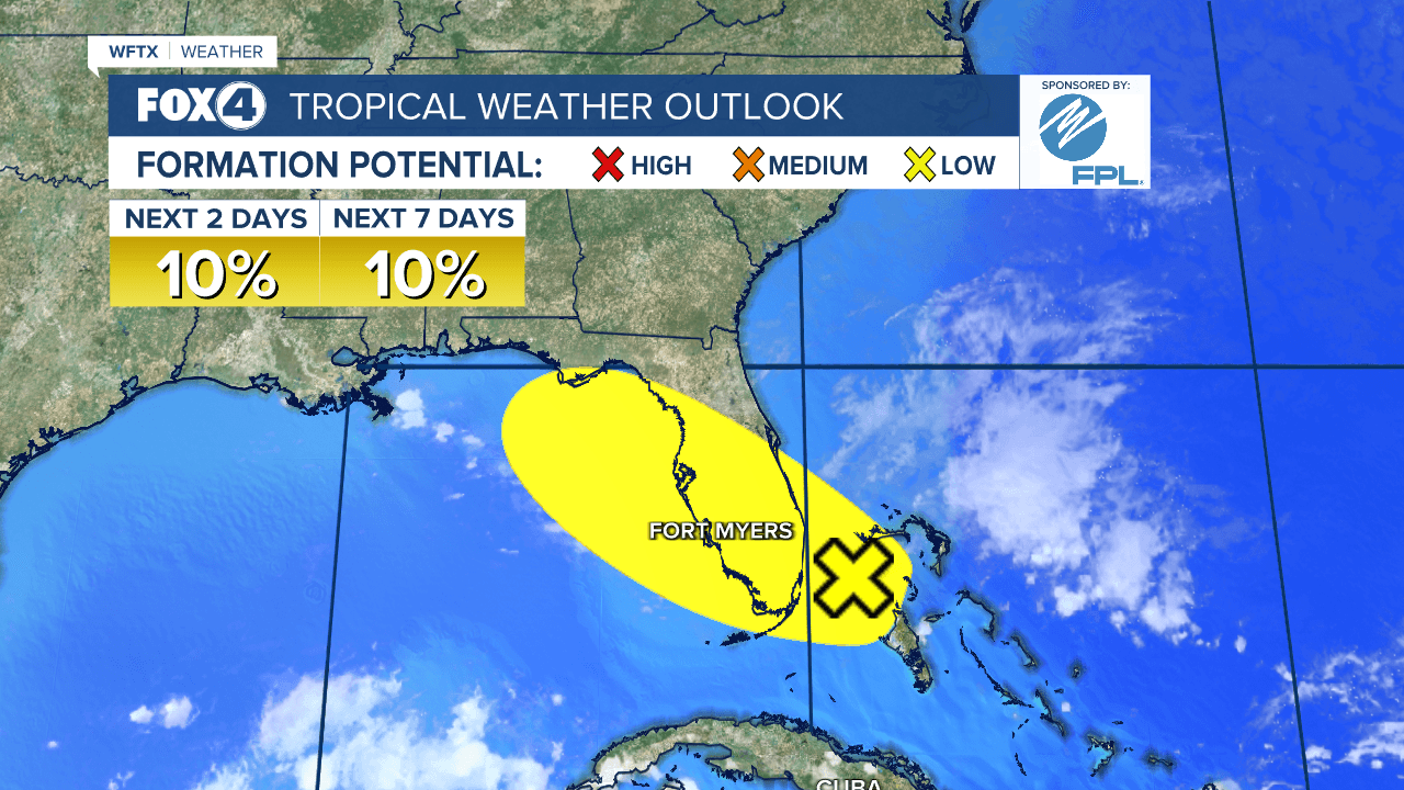
An area of low pressure may form along a remnant frontal boundary near the northwestern Bahamas and southern Florida during the next day or two. The chances are very low at just 10%.
WFTX
Neither the GFS nor European models develop any circulation at the surface.

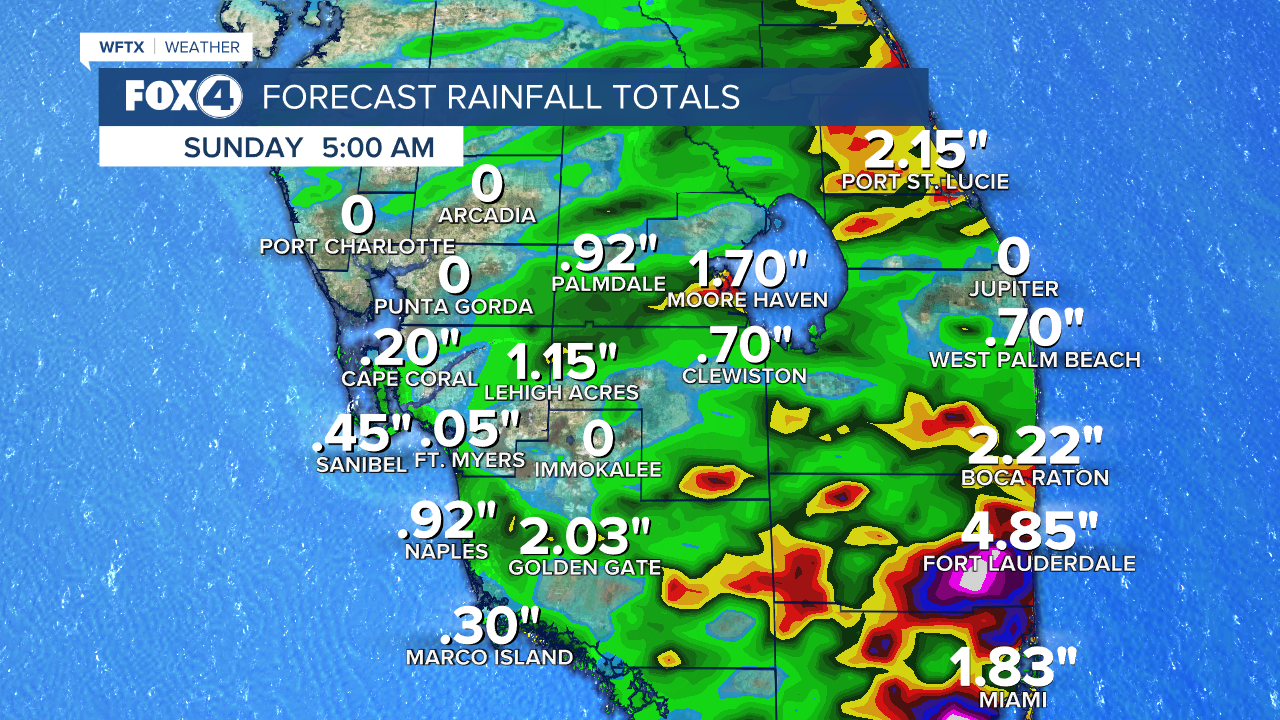
More than likely, this will be a rainmaker for Florida's East Coast, where a marginal threat for heavy rainfall is expected Saturday and Sunday with totals ranging from 2-5" through Sunday.
Any additional development is expected to be slow to occur as the system moves northwestward across the Florida Peninsula and into the Gulf.
Share: