Fox4Now
TRACKING THE TROPICS: Monitoring two disturbances in the Atlantic
Fox4Now Staff
•10/4/2025
Source: Fox4Now
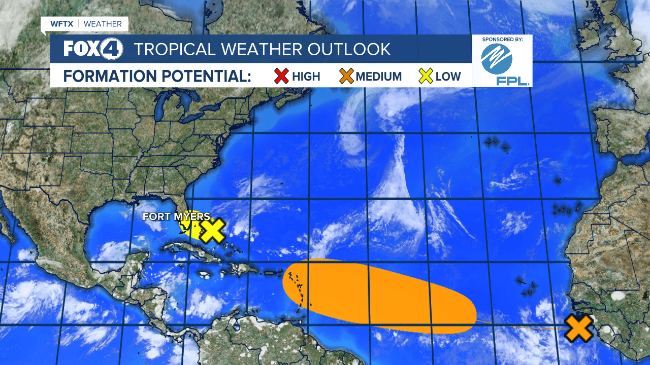
The National Hurricane Center is monitoring two weather systems in the Atlantic Ocean, including one near Florida that could bring heavy rainfall through the weekend to Florida's east coast.
System near Florida and Bahamas
A weak area of low pressure located near the central and northwestern Bahamas is producing disorganized shower activity. This system is expected to drift west-northwestward across the northwestern Bahamas and toward southern Florida during the next couple of days.

Strong upper-level winds are expected to prevent significant development of the low, however the combination of the disturbance and the broader remnant boundary is still expected to produce heavy rainfall and possible flooding for Florida's east coast and the Bahamas through the weekend.
Minimal impact is expected across SWFL.
The formation chance through 48 hours remains low at 10%. The formation chance through seven days also remains low at 10%.
Tropical wave in Central Atlantic

A tropical wave has just emerged off the coast of Africa. The wave is forecast to interact with another disturbance over the eastern tropical Atlantic, and then move westward after that.
Environmental conditions are expected to become conducive for some slow development of the system in a few days, and a tropical depression could form near or east of the Lesser Antilles by the end of next week.
The next name will be "Jerry" followed by "Karen".
Share: