Fox4Now
BREAKING: Hurricane Melissa is now a category 5 hurricane
Fox4Now Staff
•10/27/2025
Source: Fox4Now
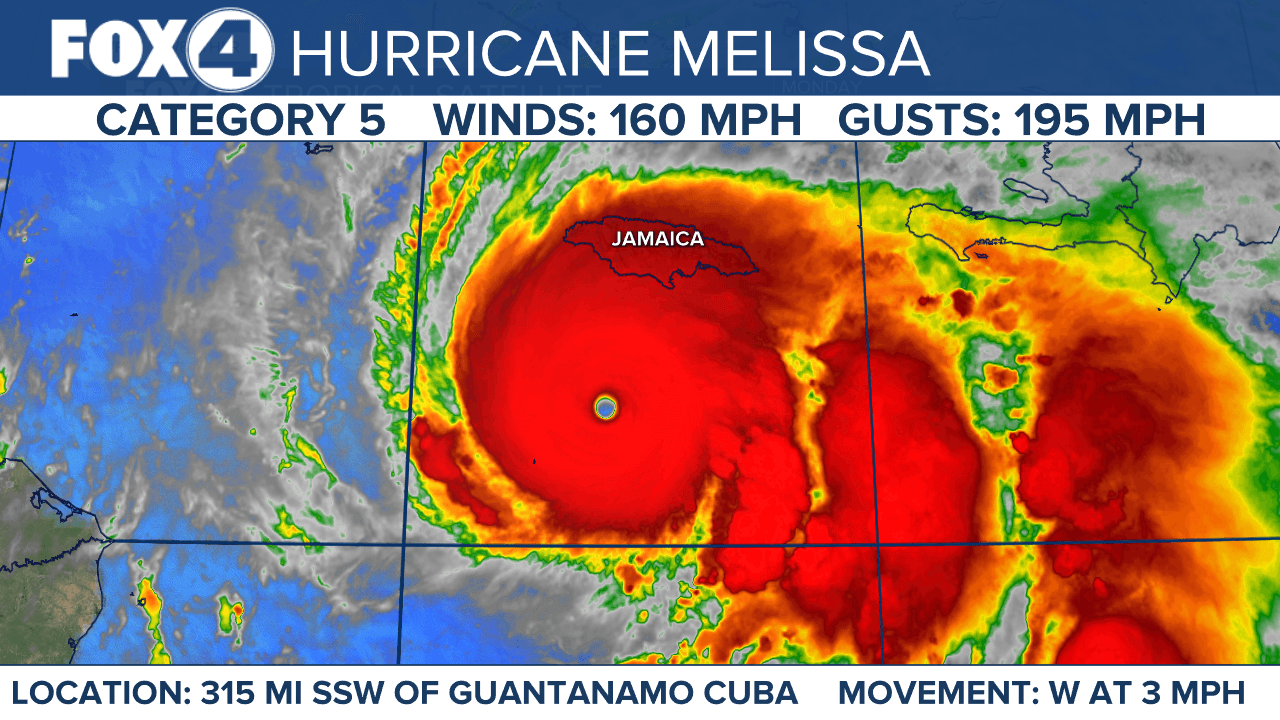
Hurricane Melissa has intensified into a catastrophic Category 5 storm with maximum sustained winds of 160 mph, positioning itself as a potentially historic threat to Jamaica as it approaches the island nation with expected landfall tomorrow.
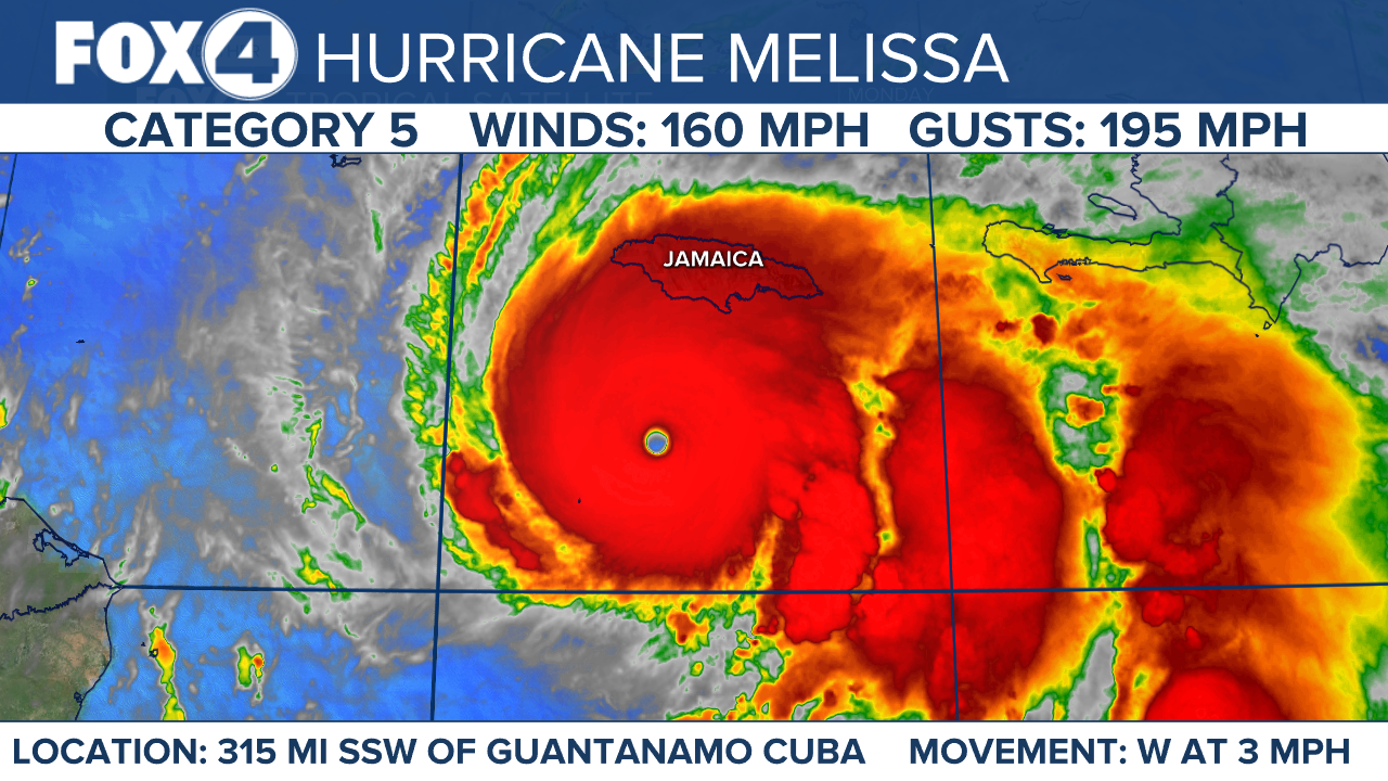
Melissa is moving toward the west near 3 mph. A slow turn toward the northwest and north is expected today and tonight, followed by a northeastward acceleration beginning on Tuesday and continuing through at least Thursday. On the forecast track, the core of Melissa is expected to move near or over Jamaica tonight and Tuesday, across southeastern Cuba Tuesday night, and across the southeastern Bahamas on Wednesday. Some additional strengthening is forecast today, with fluctuations in intensity likely before Melissa makes landfall on Jamaica early Tuesday. Melissa is expected to reach Jamaica and southeastern Cuba as a powerful major hurricane, and will still be at hurricane strength when it moves across the southeastern Bahamas. Hurricane-force winds extend outward up to 30 miles from the center and tropical-storm-force winds extend outward up to 195 miles. The minimum central pressure based on dropsonde data is 917 mb.

Catastrophic flooding and storm surge expected
Melissa threatens to bring catastrophic rainfall totals of 15 to 30 inches across Jamaica through Wednesday, with local maximum amounts potentially reaching 40 inches. These extreme rainfall amounts are expected to produce catastrophic flash flooding and numerous landslides across the affected regions.
Life-threatening storm surge along Jamaica's south coast could reach 9 to 13 feet above ground level Monday night through Tuesday morning, particularly near and east of where Melissa's center makes landfall. The storm surge will be accompanied by large and destructive waves.
Eastern Cuba faces the threat of 6 to 12 inches of rainfall, with local amounts up to 18 inches expected through Wednesday, creating life-threatening flash flooding and landslide conditions.
Warnings and watches in effect
A Hurricane Warning remains in effect for Jamaica, meaning hurricane conditions are expected and preparations to protect life and property should be complete.
A Hurricane Watch covers the southwestern peninsula of Haiti from the Dominican Republic border to Port-Au-Prince, as well as the Cuban provinces of Granma, Santiago de Cuba, Guantanamo and Holguin.
A Tropical Storm Warning is active for southwestern Haiti from the Dominican Republic border to Port-Au-Prince.
Officials warn that interests throughout Haiti, the Dominican Republic, Cuba, the southeastern and central Bahamas, and the Turks and Caicos Islands should closely monitor Melissa's progress as additional watches and warnings may be required.
Infrastructure damage anticipated
Extensive infrastructural damage, long-duration power and communication outages, and isolation of communities are expected across Jamaica as Melissa approaches. The combination of damaging winds beginning Sunday and Monday, followed by potentially devastating hurricane-force winds Monday night and Tuesday morning, creates a multi-day threat for the island nation.
In Haiti, catastrophic flash flooding and landslides are expected across the southwestern region through midweek, likely causing extensive infrastructure damage and community isolation. While winds have temporarily decreased on the Tiburon peninsula, they could increase again across much of western Haiti on Tuesday.
The Dominican Republic faces the threat of heavy rainfall through midweek that could produce catastrophic flash flooding and numerous landslides in southern portions of the country.
After affecting the Caribbean, Melissa is forecast to accelerate toward the northeast when picked up by a weather system moving off the southeastern United States coast, potentially reaching the vicinity of Bermuda by Friday.
Share: