Local News
Heat and humidity building: how Saturday will feel across SWFL
Oceana Hayden
•4/18/2026
Source: WINK News

SOUTHWEST FLORIDA, (WINK) — Saturday is off to a warm start, with many areas not even dipping into the 60s this morning. Winds will remain light early, becoming southeasterly in the afternoon before shifting westerly by evening at 5–15 mph.
High temperatures will climb to around 90° for many areas around 3-4 PM, while coastal communities stay a few degrees cooler.
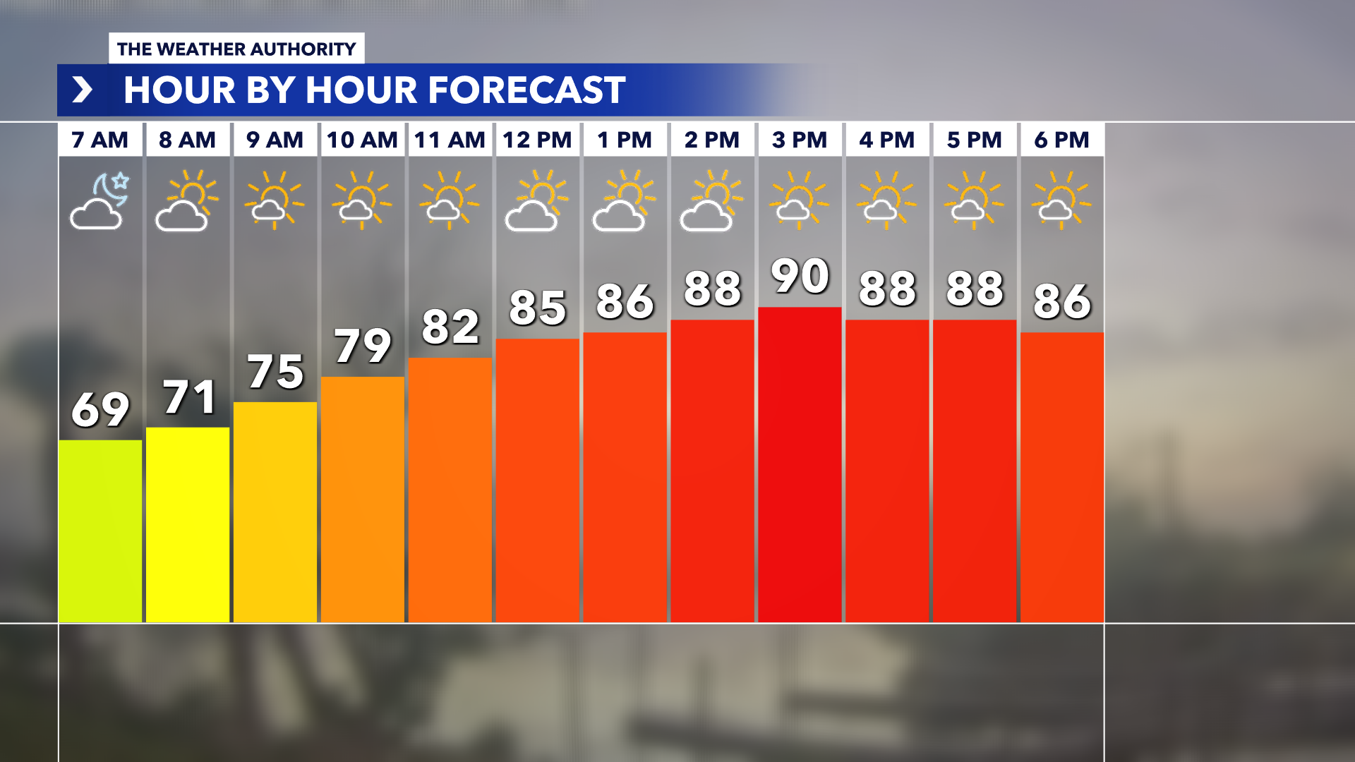
It will feel a little more humid today as well. If you're heading to the beach or pool, be sure to bring plenty of water, and maybe an umbrella for shade. Rain isn’t a concern, as partly cloudy skies are expected to remain dry throughout the day. A stray shower can’t be ruled out inland after sunset, but most spots will stay rain-free.
Saturday Forecast
Saturday is off to a warm start, with many areas not even dipping into the 60s this morning. Winds will remain light early, becoming southeasterly in the afternoon before shifting westerly by evening at 5–15 mph.

High temperatures will climb to around 90° for many areas around 3-4 PM, while coastal communities stay a few degrees cooler. It will feel a little more humid today as well. If you're heading to the beach or pool, be sure to bring plenty of water, and maybe an umbrella for shade. Rain isn’t a concern, as partly cloudy skies are expected to remain dry throughout the day. A stray shower can’t be ruled out inland after sunset, but most spots will stay rain-free.
Sunday Outlook
Sunday starts in a similar fashion, with morning temperatures near 70°. Another quick warm-up is expected, with some spots once again reaching 90°.
Winds will stay relatively light, but skies will turn a bit cloudier as moisture increases ahead of an approaching cold front. Rain chances remain low overall, though spot afternoon showers are possible. Most areas will stay dry.
Looking Ahead
A shift in the pattern arrives Monday as a cold front moves through the region. This could bring isolated thunderstorms, particularly during the evening hours, potentially impacting your commute home from work.
Temperatures will remain warm but trend closer to seasonal averages, settling into the mid-80s through the week. Behind the front, drier and breezier conditions are expected. This will elevate fire weather concerns, especially on Tuesday and Wednesday.
Overall, conditions look mostly dry as we head toward next weekend.
Beach & Boating Forecast
It’s shaping up to be a great weekend to get out on the water. East to southeast winds will keep seas low, with wave heights around 1–2 feet and only a light chop on bays and inland waters.

The UV index will be very high, around 11, so be sure to apply sunscreen regularly. Gulf water temperatures remain comfortable, holding near 78°.
Share: